
Hunting Iceland’s Hidden Volcano Craters
Three Years, approx. 140 Craters And The Landscapes That Changed Everything
Photographed and written by Julia Mustonen-Dahlkvist


For the last three years Iceland slowly became less of a destination and more of an obsession for me.
What started as a photography project eventually turned into years of exploring volcanic landscapes, hidden crater systems and remote areas of the Highlands where roads disappear into lava deserts, weather changes every thirty minutes and the earth itself feels unfinished somehow.
Over these years I photographed more than 140 volcanic craters across Iceland.
Not only the famous locations everybody already knows, but also remote volcanic formations hidden deep inside places like Landmannalaugar, Laki, Eldgjá, Northern Iceland, Snæfellsnes and the endless Highlands stretching between glaciers and black sand deserts.
And honestly, after all these years it still feels like Iceland keeps revealing new versions of itself every single time I return.
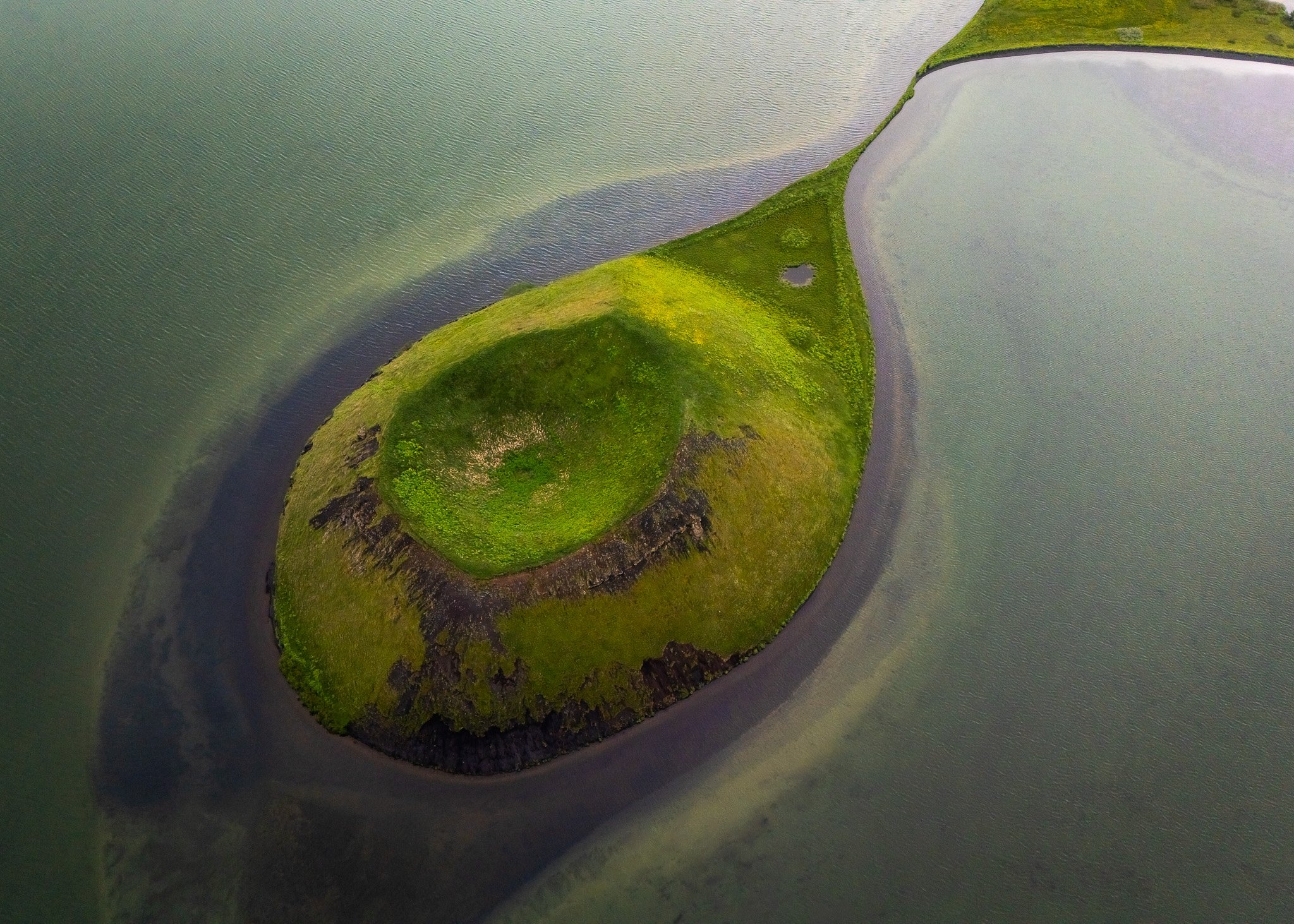
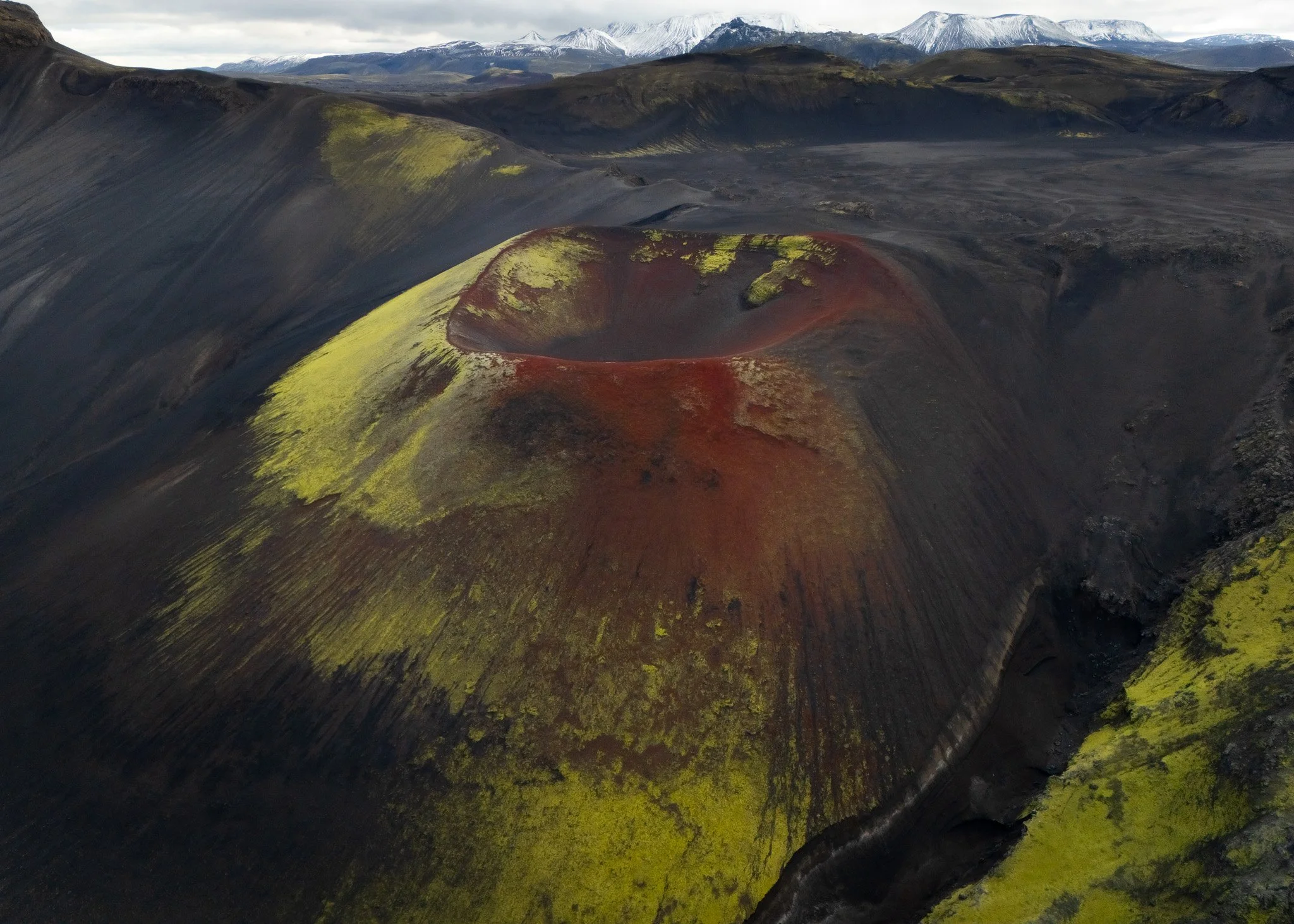
Landmannalaugar
Iceland Never Feels Still
One of the strangest things about Iceland is that the country never feels ancient in the normal way landscapes usually do.
In many places around the world mountains feel permanent and settled, shaped long ago into something stable and predictable, but Iceland constantly reminds you that the ground underneath is still moving, erupting and reshaping itself.
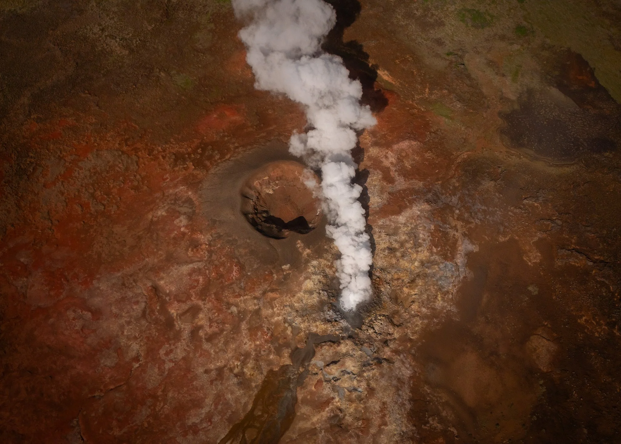
Steam rises from the earth in random places. Lava fields still look fresh centuries after eruptions. Giant fissures split landscapes apart and volcanic cones appear scattered across entire regions almost casually, as if fire surfaced for a moment and then disappeared again without warning.
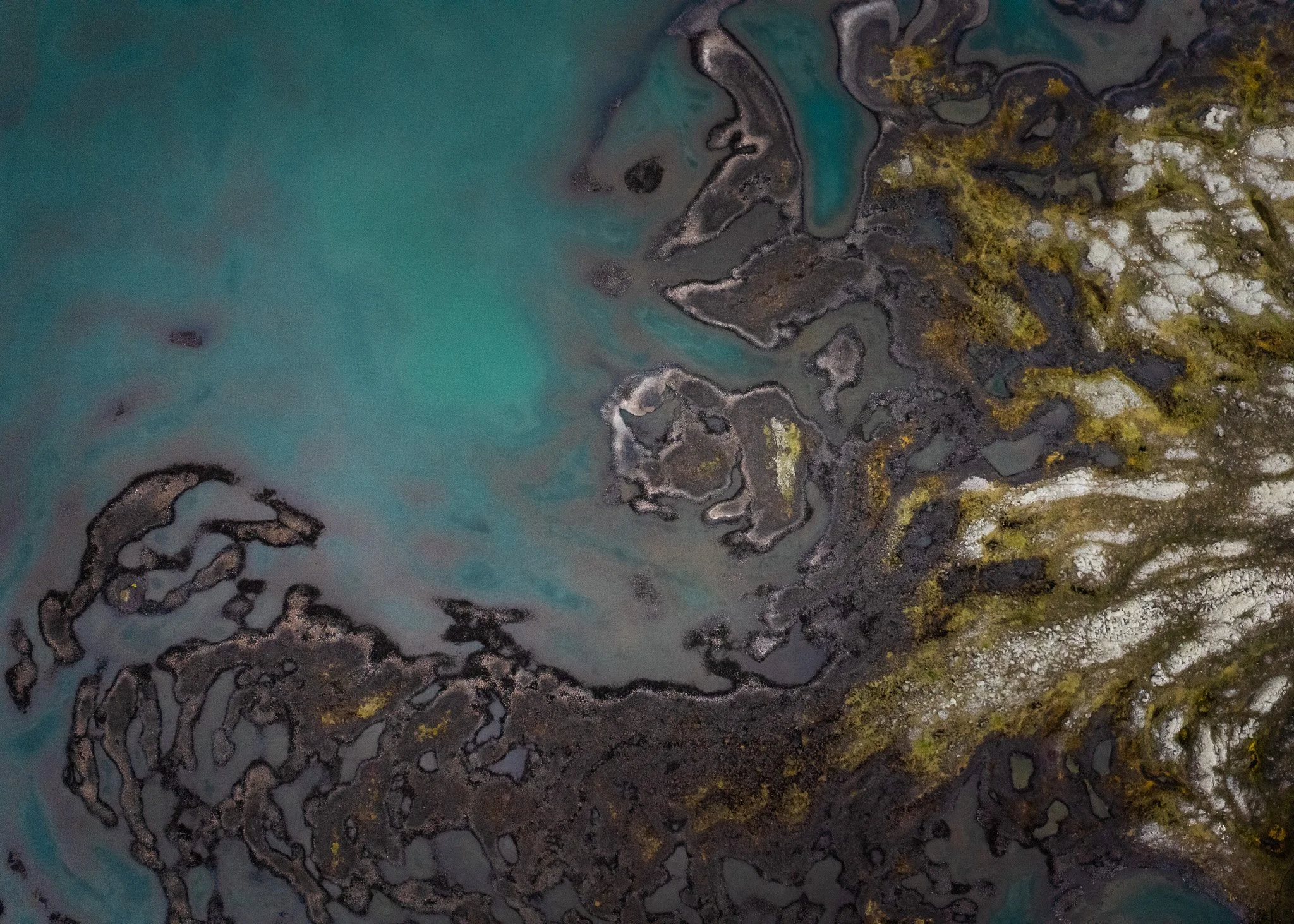
After spending years specifically searching for volcano craters, I started noticing how different every volcanic landscape actually feels.
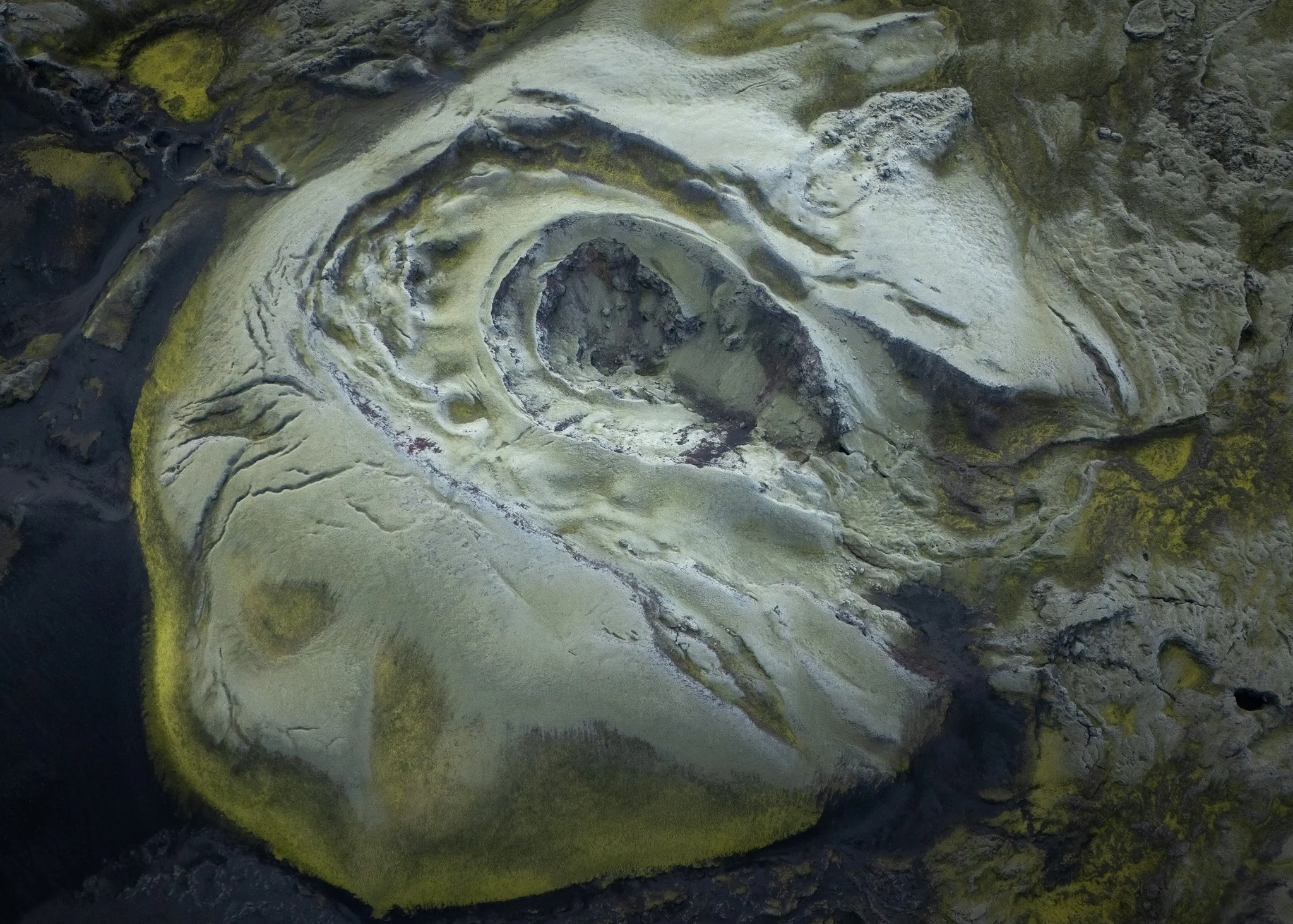
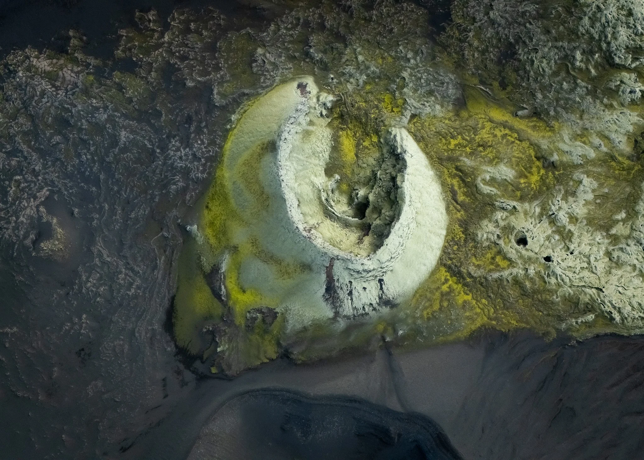
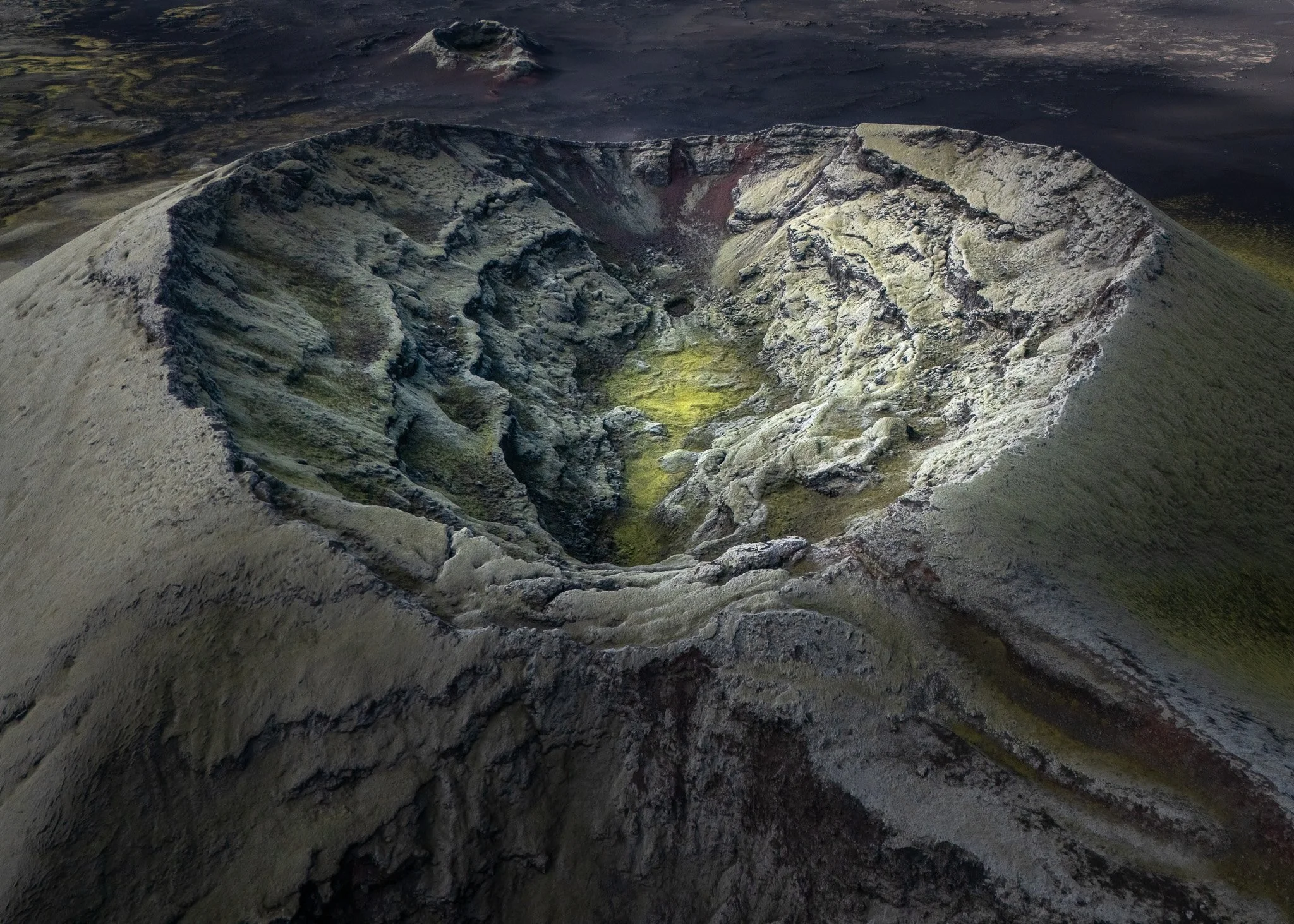
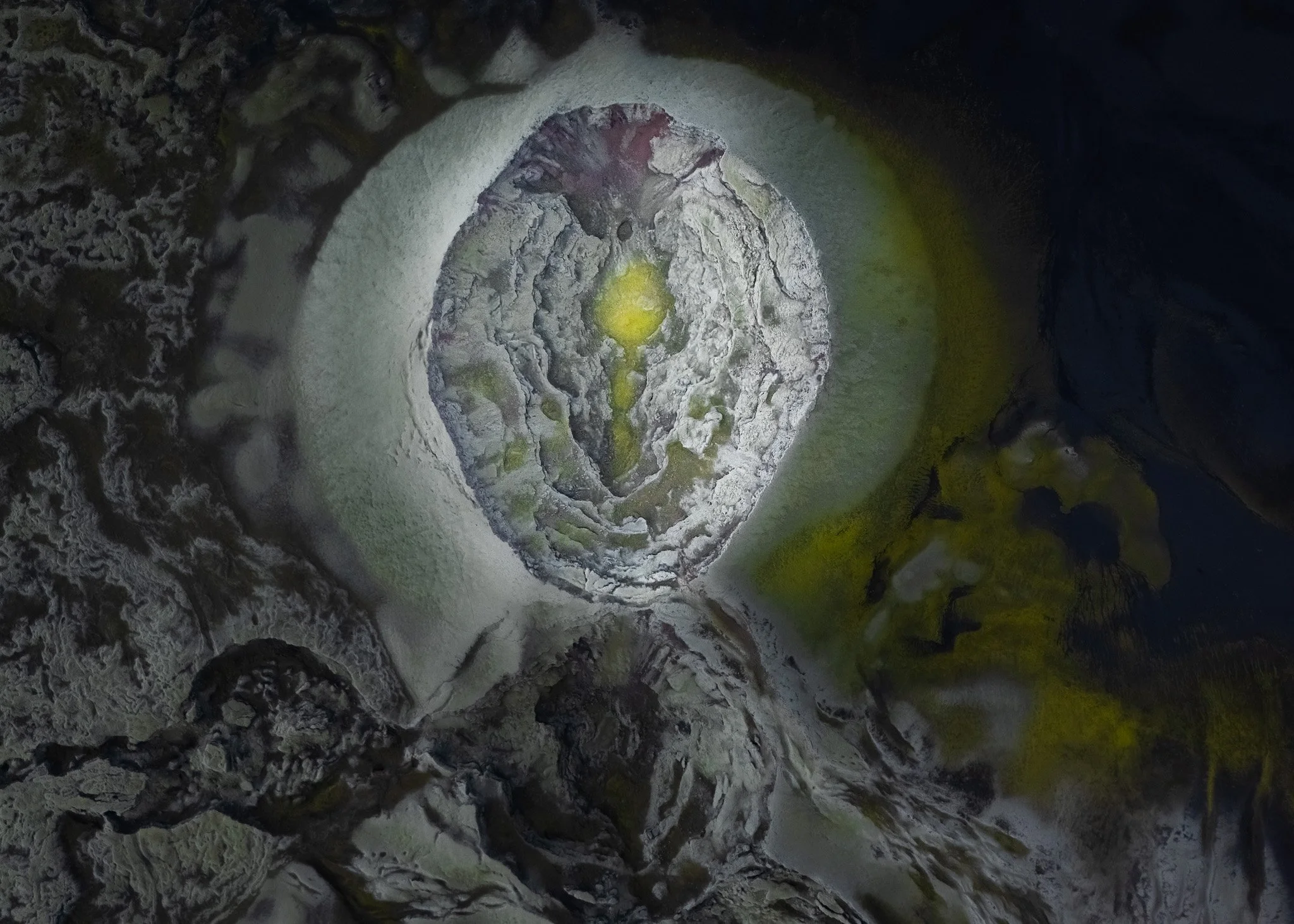
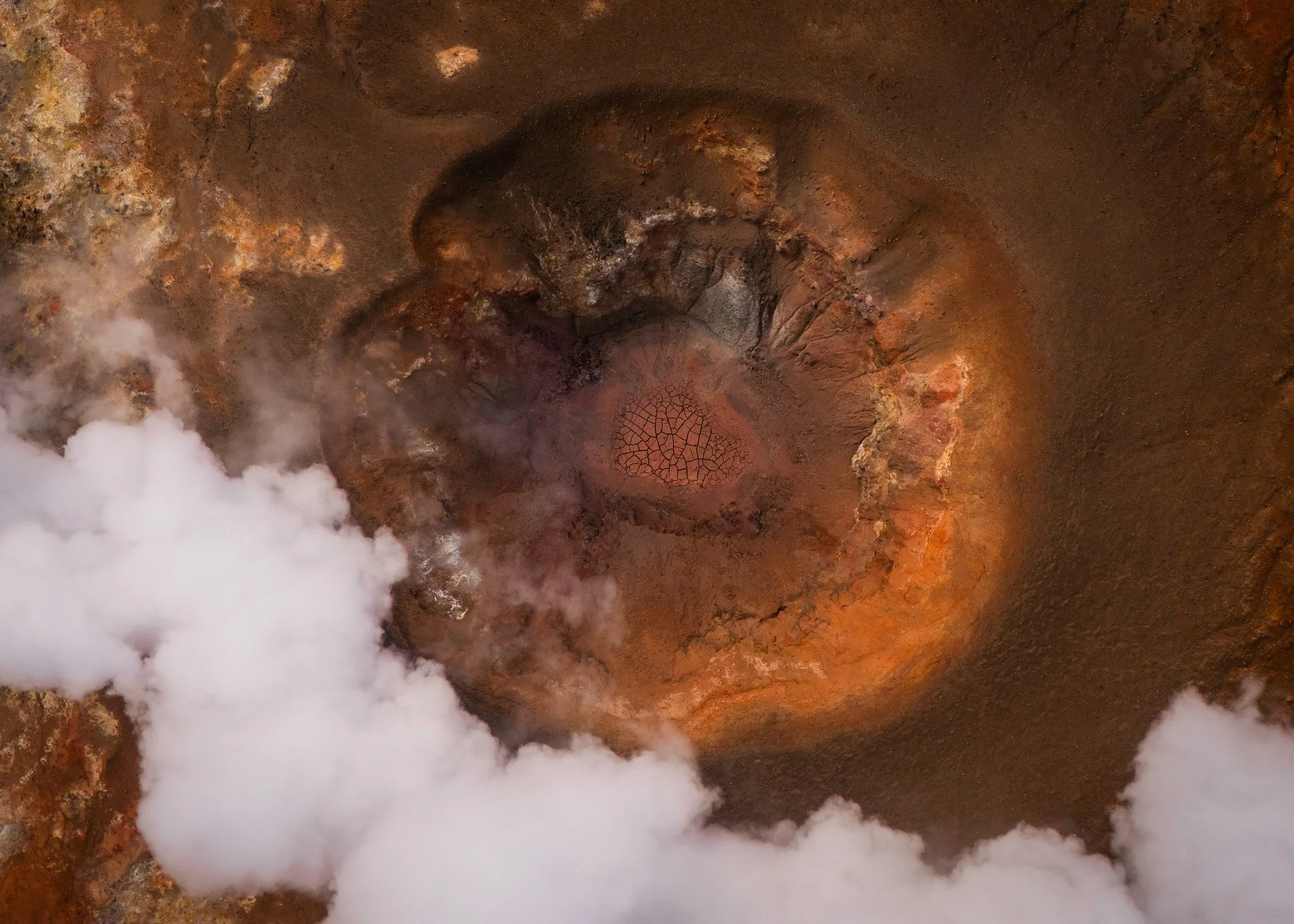
Hverfjall near Mývatn almost feels mathematically perfect from above, with its enormous circular crater shaped so evenly that it looks designed instead of created through explosive force. The symmetry becomes almost surreal once the drone lifts high enough above the rim and you suddenly see the entire cone isolated against the darker volcanic terrain surrounding it.
Myvatn
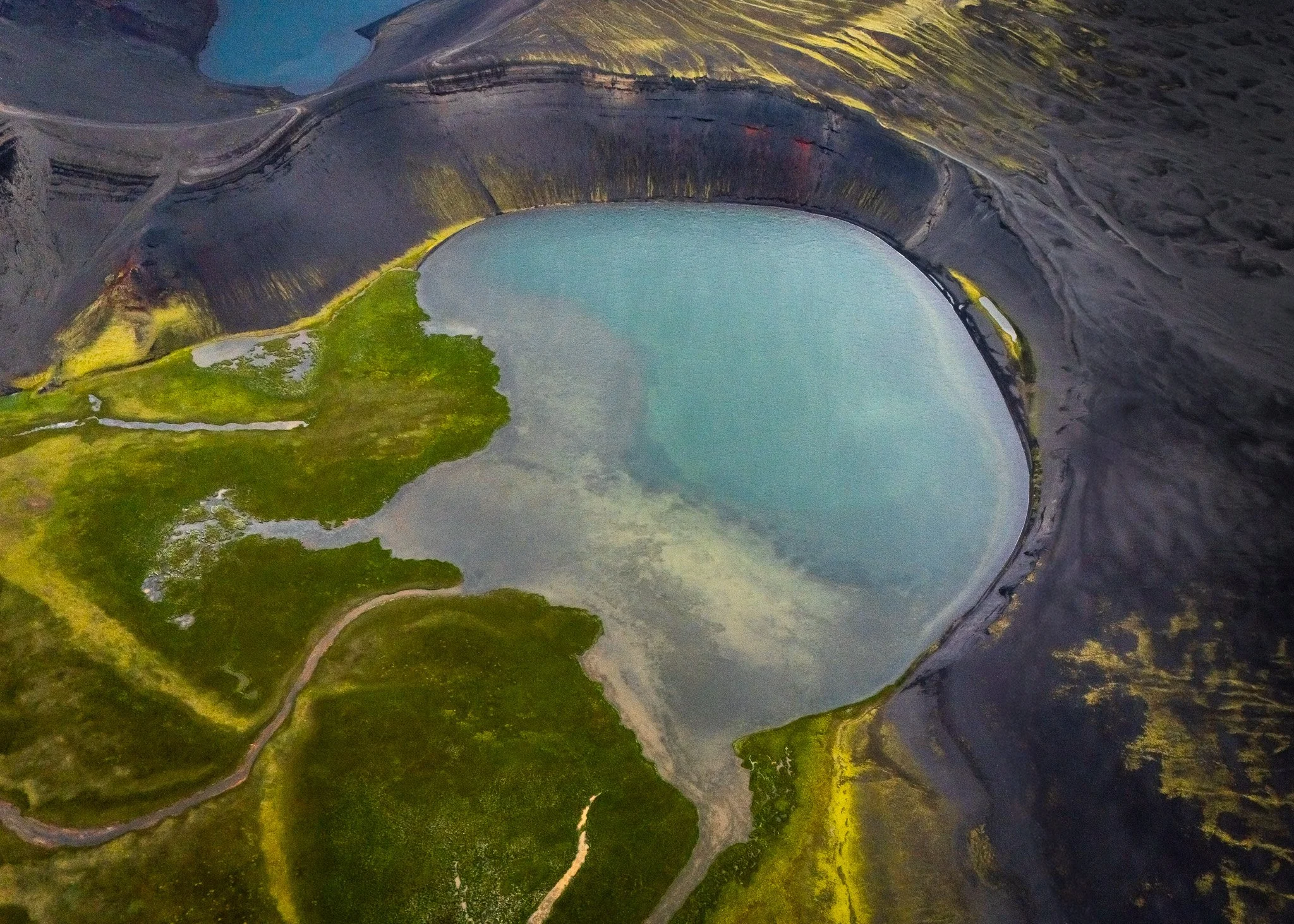
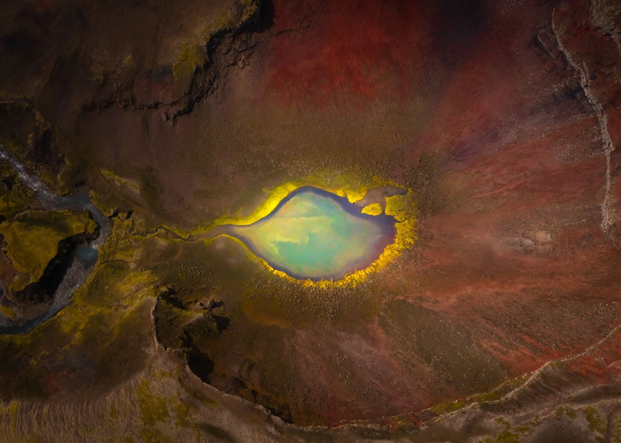
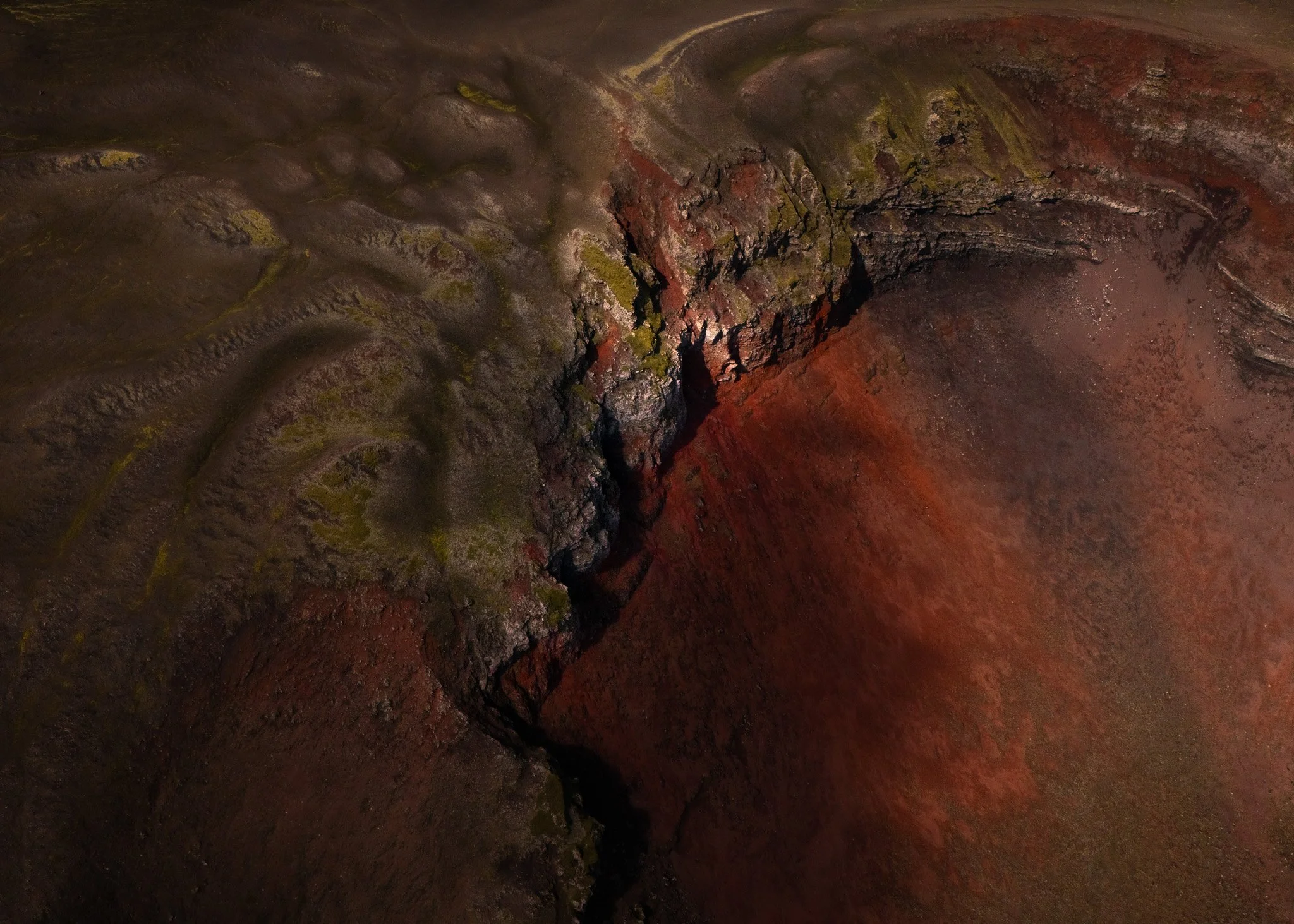
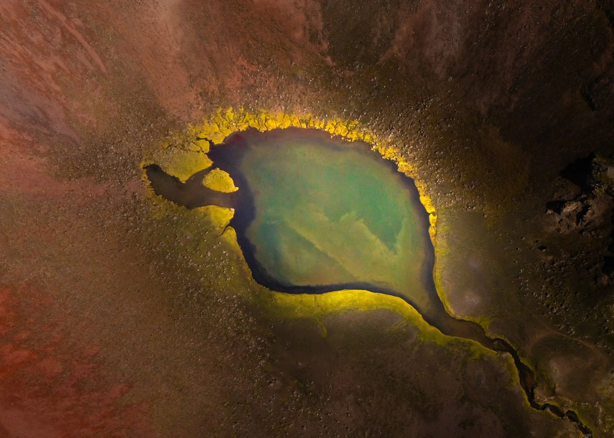
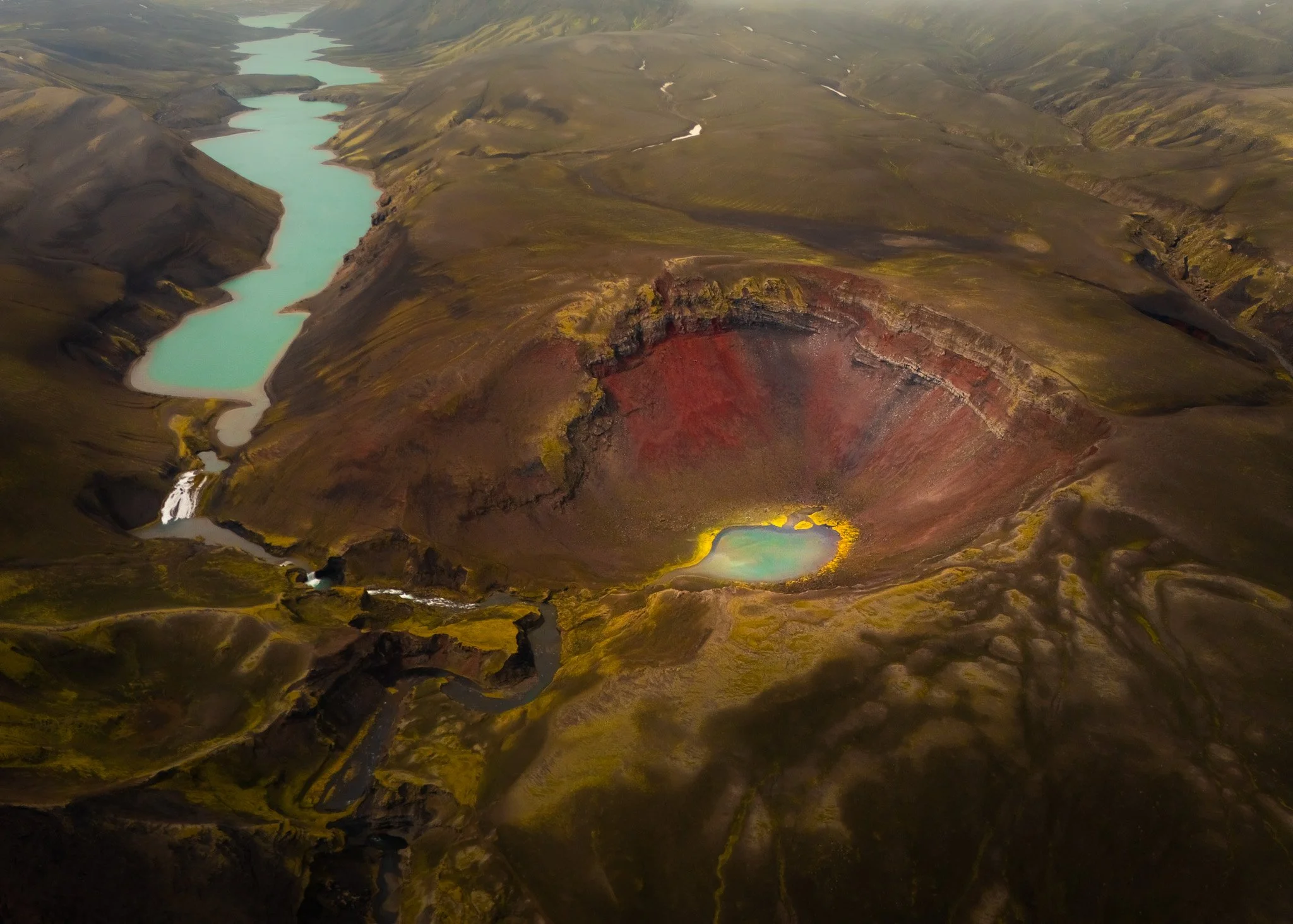
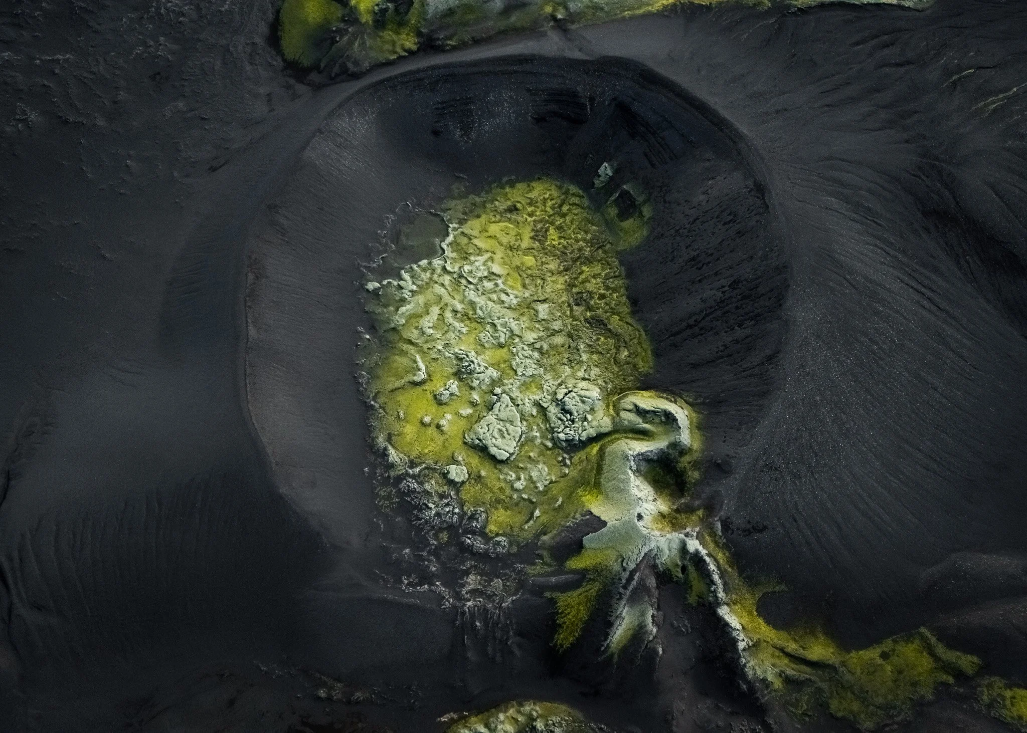
Then there are places like Ljótapollur in the Highlands, where deep red crater walls collapse toward intensely blue water created after explosive eruptions violently met groundwater centuries ago. The contrast there honestly looks unreal in changing weather, especially when fog moves slowly through the surrounding valleys and the lake becomes perfectly still.
And then Iceland changes again completely.
At Bláhylur the landscape becomes quieter somehow. The blue tones inside the crater almost absorb the sky itself, especially during overcast conditions when the colors deepen instead of fading. Standing there never felt dramatic in the traditional volcanic sense. It felt still. Almost unnaturally calm considering the violent geology that created it.
The Highlands Change Your Entire Relationship With Photography
Most people visiting Iceland stay close to the Ring Road and the famous waterfalls, but almost everything that inspired this project happened far beyond those areas. The real Iceland for me began once the asphalt disappeared.
Landmannalaugar
Driving into the Highlands changes your entire relationship with both photography and travel because the landscape becomes so large, isolated and unpredictable that you stop thinking like a tourist completely. Some days I drove for hours through volcanic deserts without seeing another car, crossing rough F-roads between glaciers, rivers and black sand plains while storms slowly moved across the mountains in the distance.
And honestly, those drives became just as important as the destinations themselves.
The Highlands force you to slow down and pay attention differently. You begin reading weather constantly, watching cloud formations build over volcanic ridges, checking river conditions and observing how fog moves through valleys because Iceland can become dangerous very quickly once conditions change.
People online often romanticize Highland driving and make it look cinematic and easy, but the reality is that Iceland decides everything out there.
Some crater systems required hours of driving through rough terrain with no signal, no fuel stations and weather changing every few minutes. Sometimes glacier rivers became too dangerous to cross later in the day as temperatures increased and meltwater intensified. Other times volcanic sandstorms reduced visibility almost completely.
And strangely enough, many of the best photographs happened exactly during those difficult conditions.
Fog simplified the volcanic terrain into abstract black-and-white compositions. Snowstorms erased depth completely from lava fields. Wind pushed volcanic dust across crater ridges in ways that made the entire landscape feel alive.
Searching For Craters Became An Addiction
North Iceland
At some point this project stopped becoming photography in the normal sense.
Instead of planning trips around famous locations, I started planning entire expeditions around crater systems hidden across Iceland’s interior. Satellite maps slowly became an obsession. I spent endless nights scanning volcanic terrain, searching for strange circular formations, unusual textures and isolated geological patterns that might become visually interesting from above.
Sometimes I found locations that barely existed online at all.
And honestly, discovering those places became one of the most exciting parts of the entire project.
There is something addictive about finding a hidden volcanic formation deep inside Iceland, driving for hours through rough roads just to reach it and then finally standing there completely alone surrounded by landscapes that still feel untouched.
Some places immediately stayed in my memory forever.
Eldgjá for example never really felt like a crater at all. From above it looked more like the earth itself had been sliced open across southern Iceland. The fissure stretches endlessly through the landscape, carved during one of the largest lava eruptions in recorded history, and when seen from the air it almost resembles a giant scar cutting through the Highlands.
Laki
Then there is Laki.
Laki feels completely different from most volcanic landscapes because there is no single focal point. No perfect crater. No dramatic mountain rising from the terrain. Instead lava spread endlessly outward across the land during the catastrophic eruptions of 1783, creating a landscape defined by expansion rather than explosion.
Walking there feels strange because the eye never really settles anywhere. Lava fields continue endlessly across the horizon while moss slowly softens the surface over centuries. It feels calm today, but underneath that silence you constantly remember the scale of destruction that created it.
Laki
Iceland From Above Revealed Another Planet
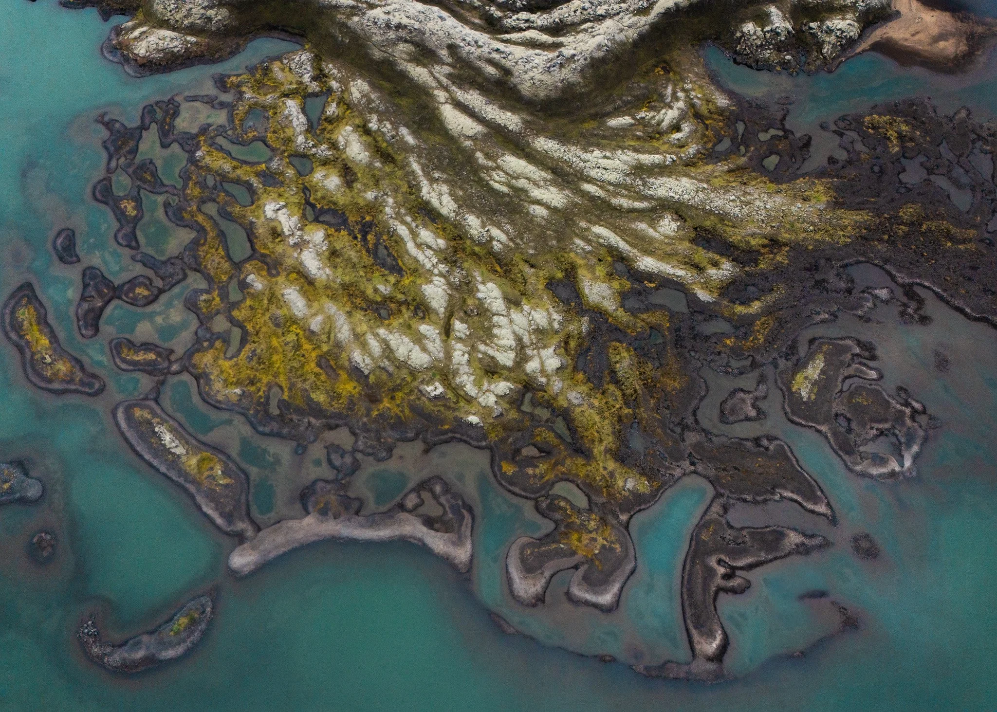
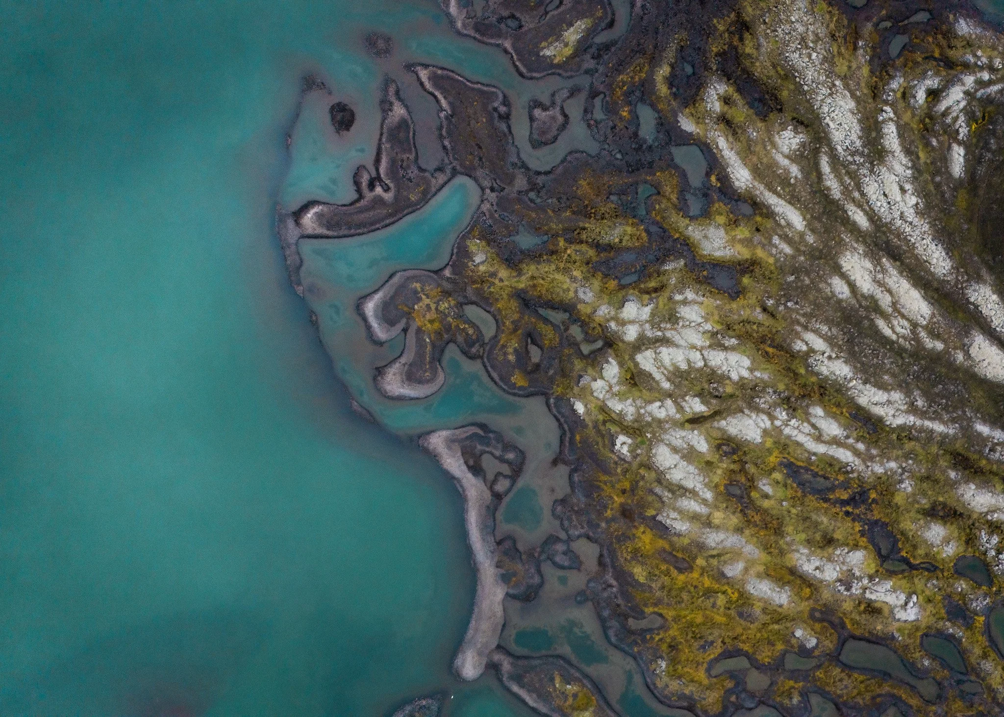
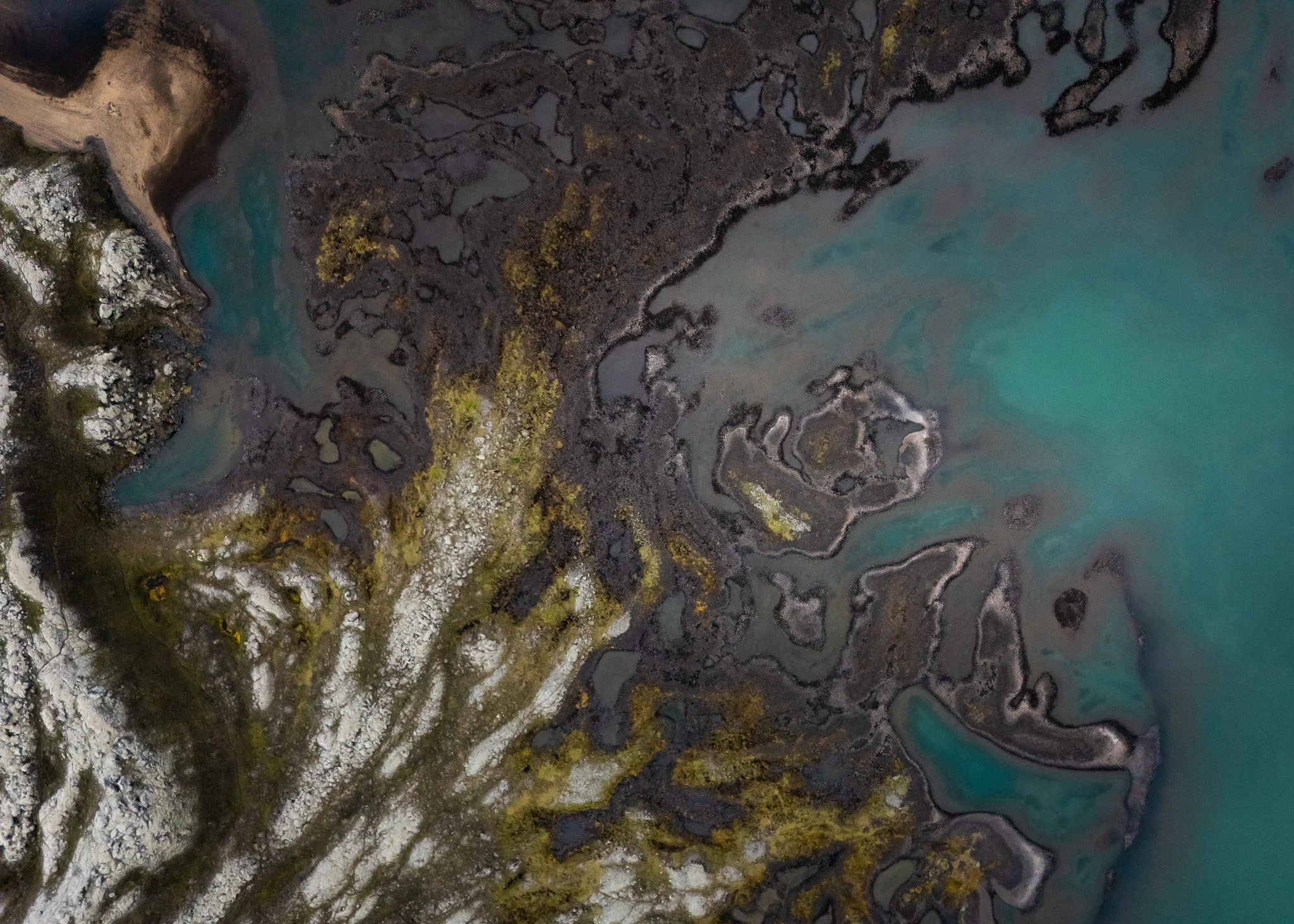
One of the biggest reasons this project evolved into something much larger than expected was because many volcanic landscapes only truly reveal themselves from the air.
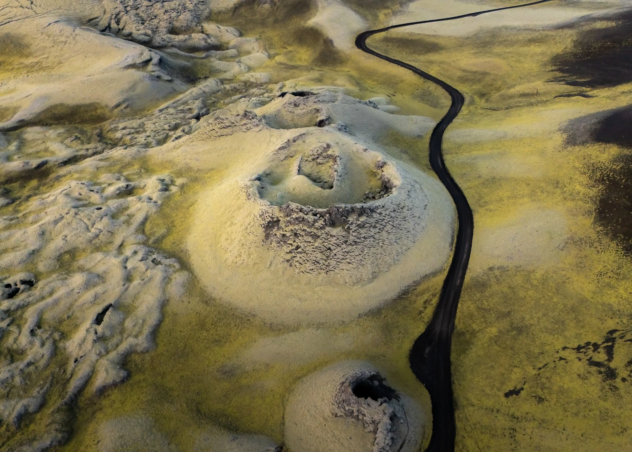
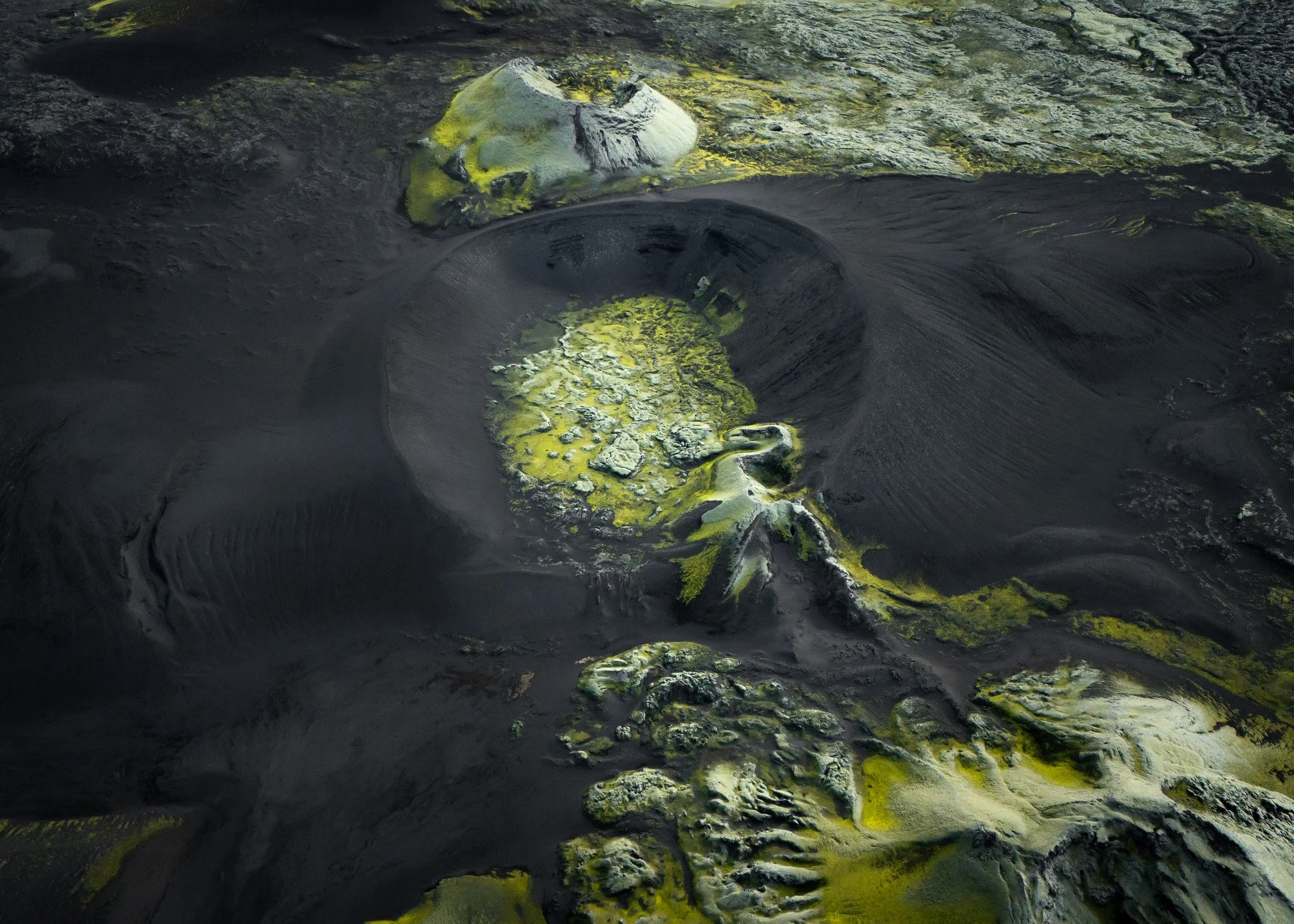
From the ground some locations looked relatively ordinary, but the moment the drone lifted above them the entire terrain transformed completely. Volcanic systems became visible stretching across huge distances, frozen rivers carved white abstract patterns through black lava fields and crater formations suddenly appeared connected to surrounding geological structures in ways impossible to understand from below.
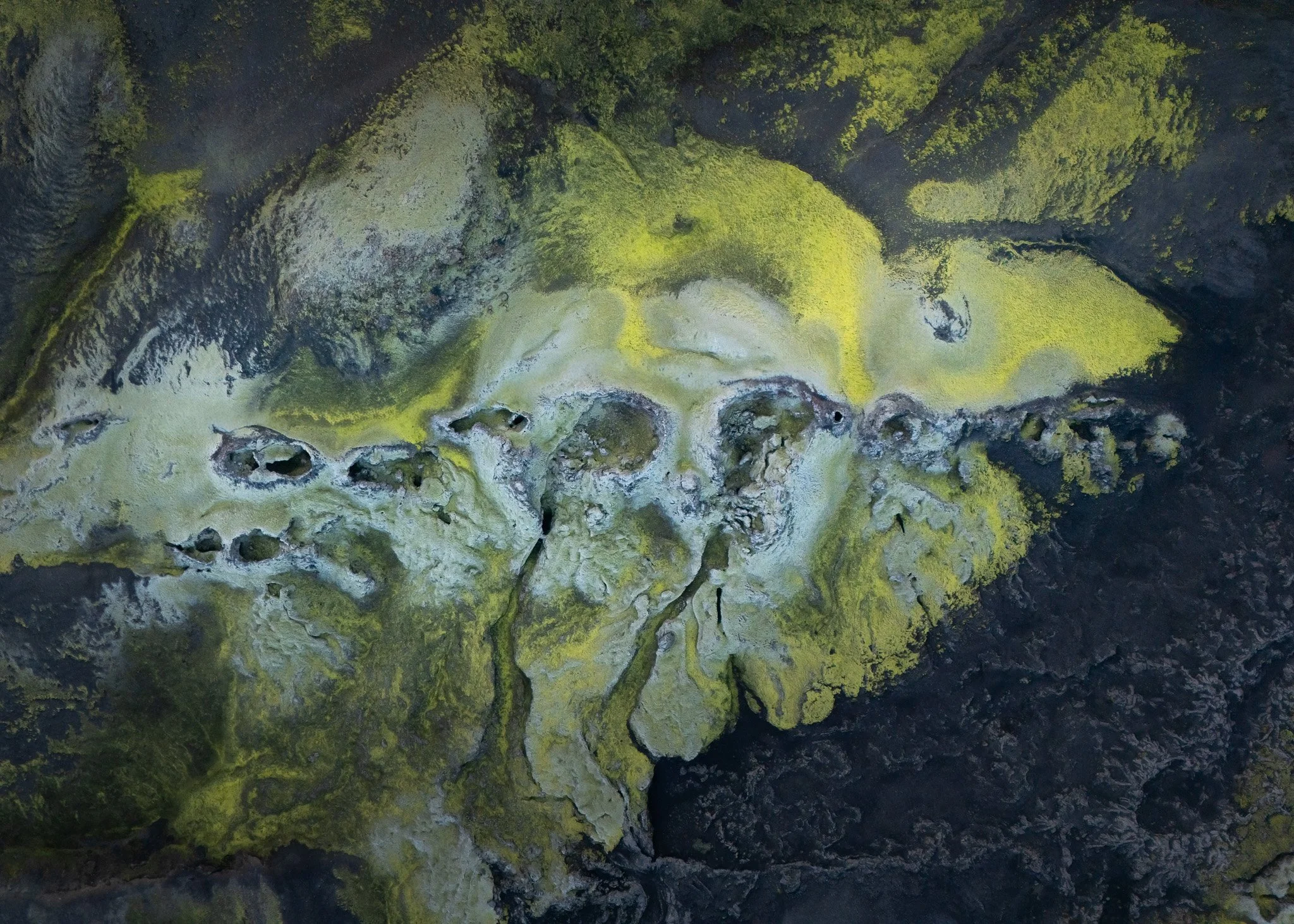
Northern Iceland especially became incredible from above.
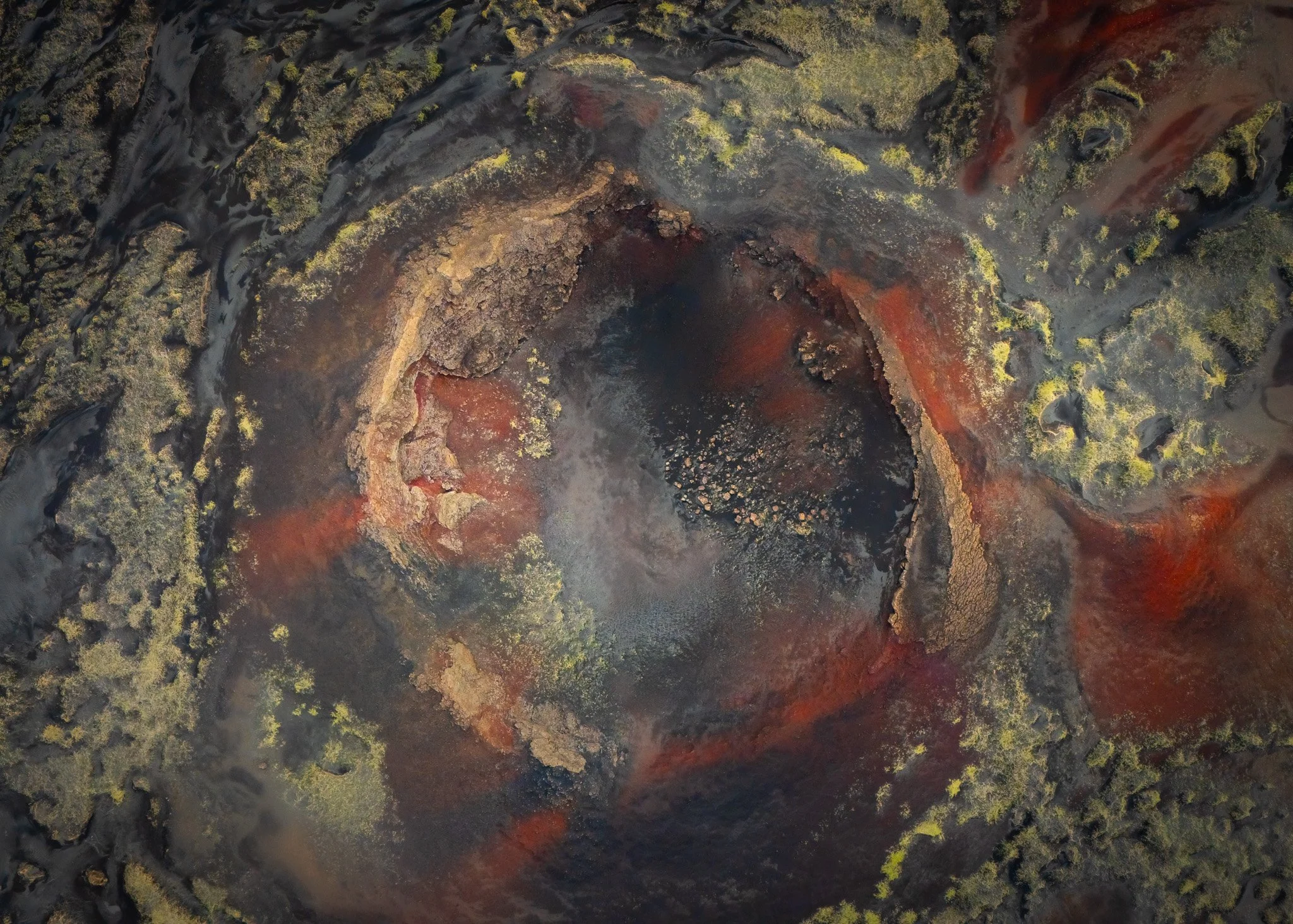
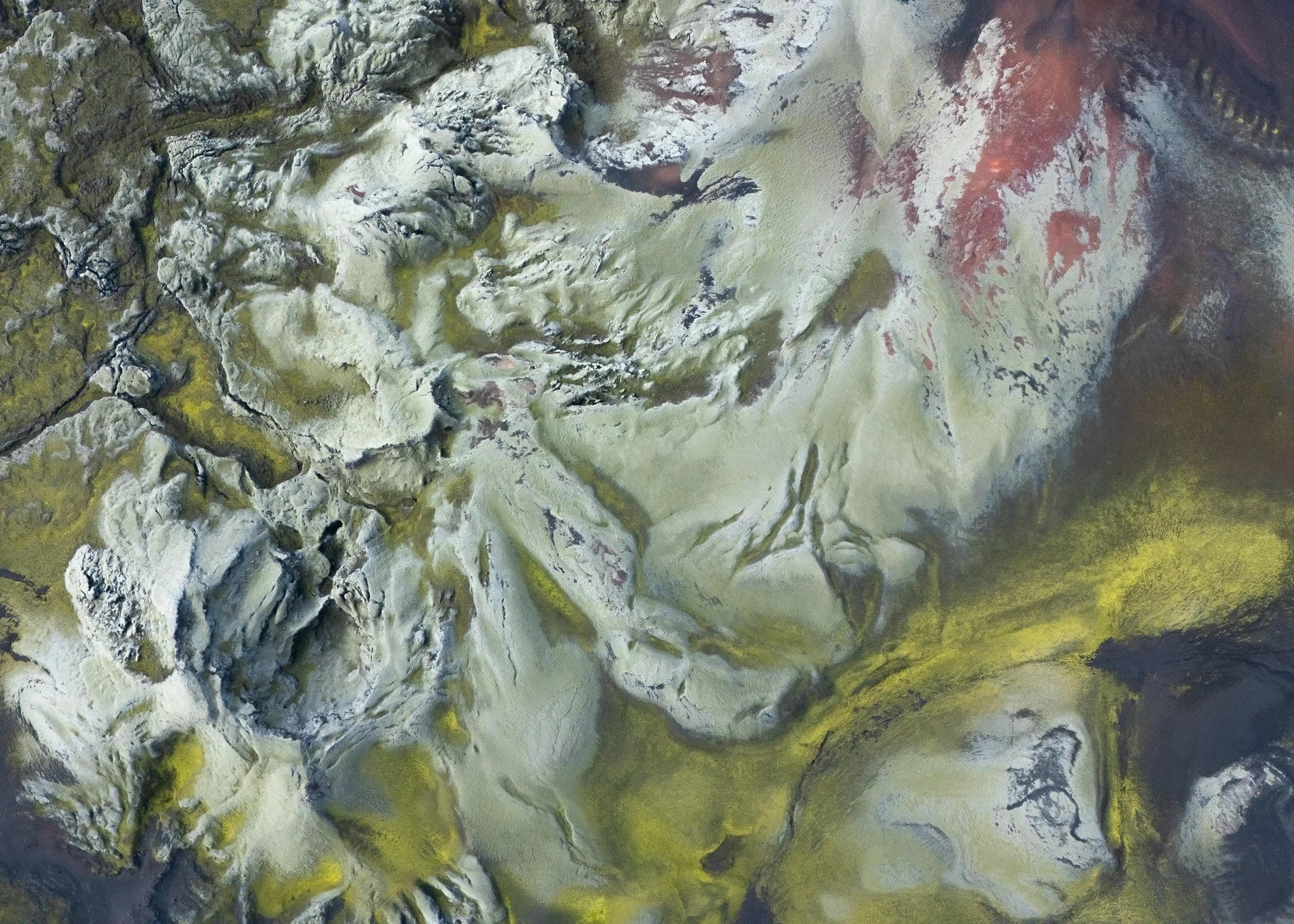
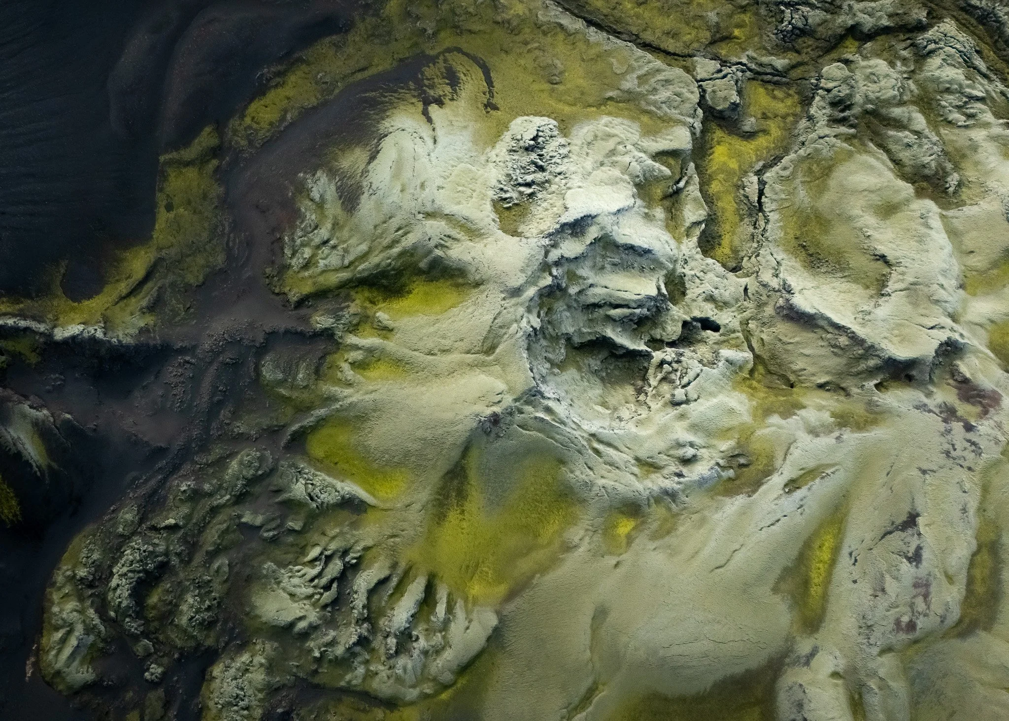
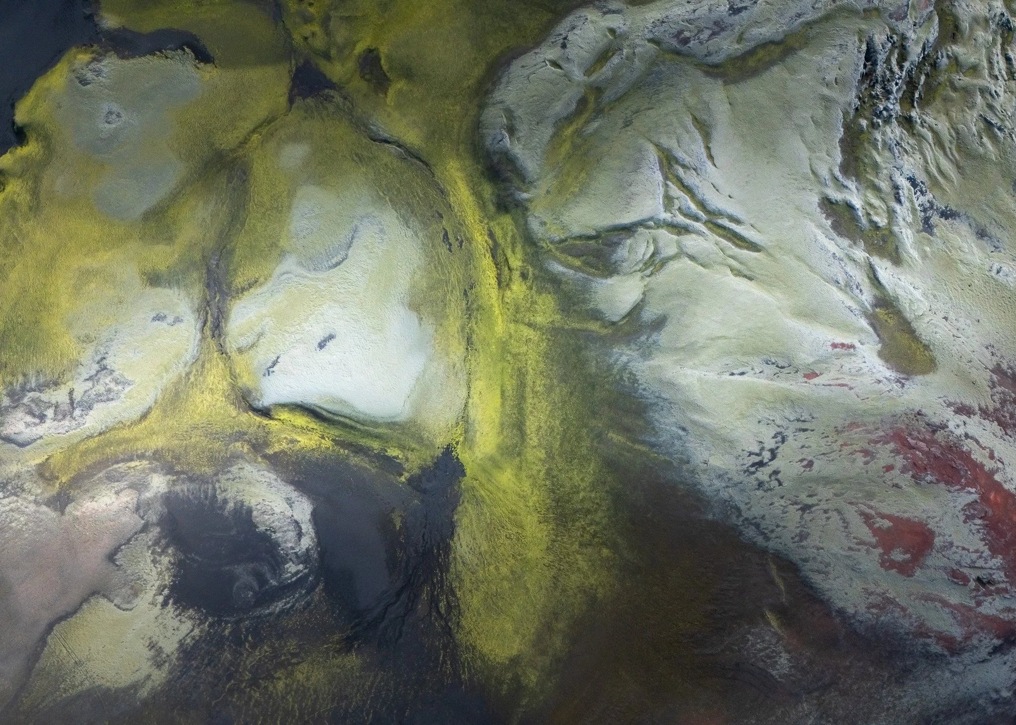
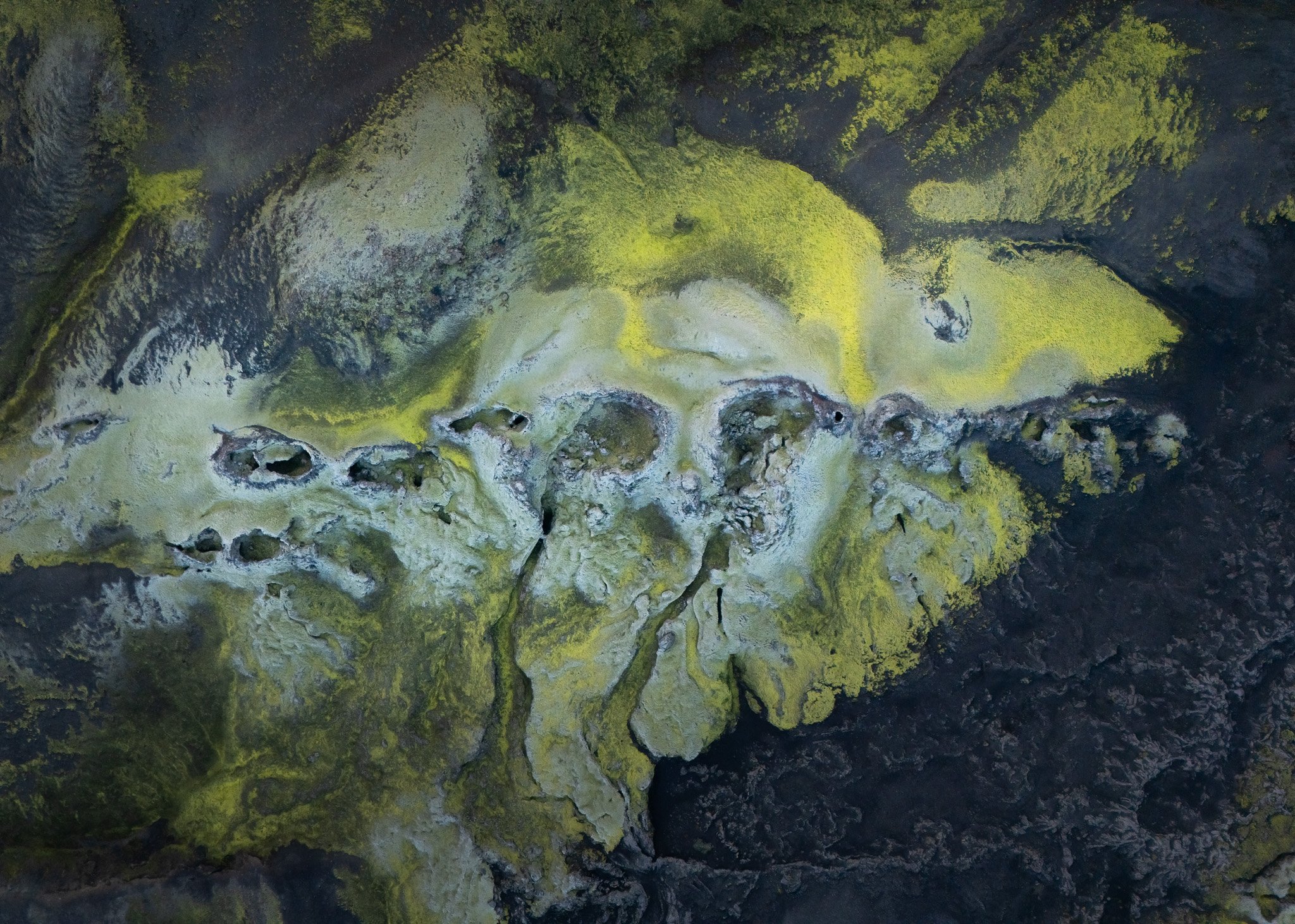
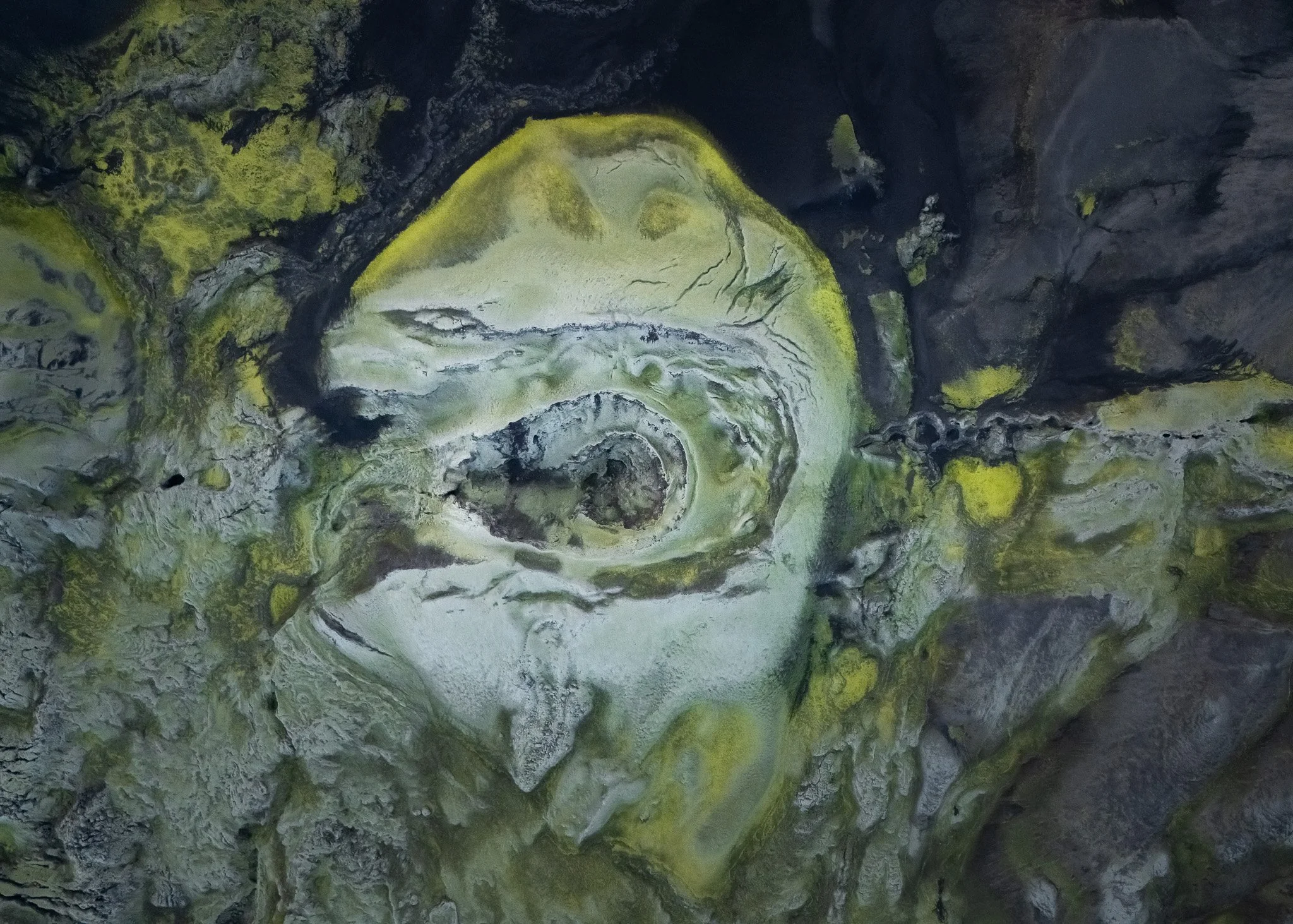
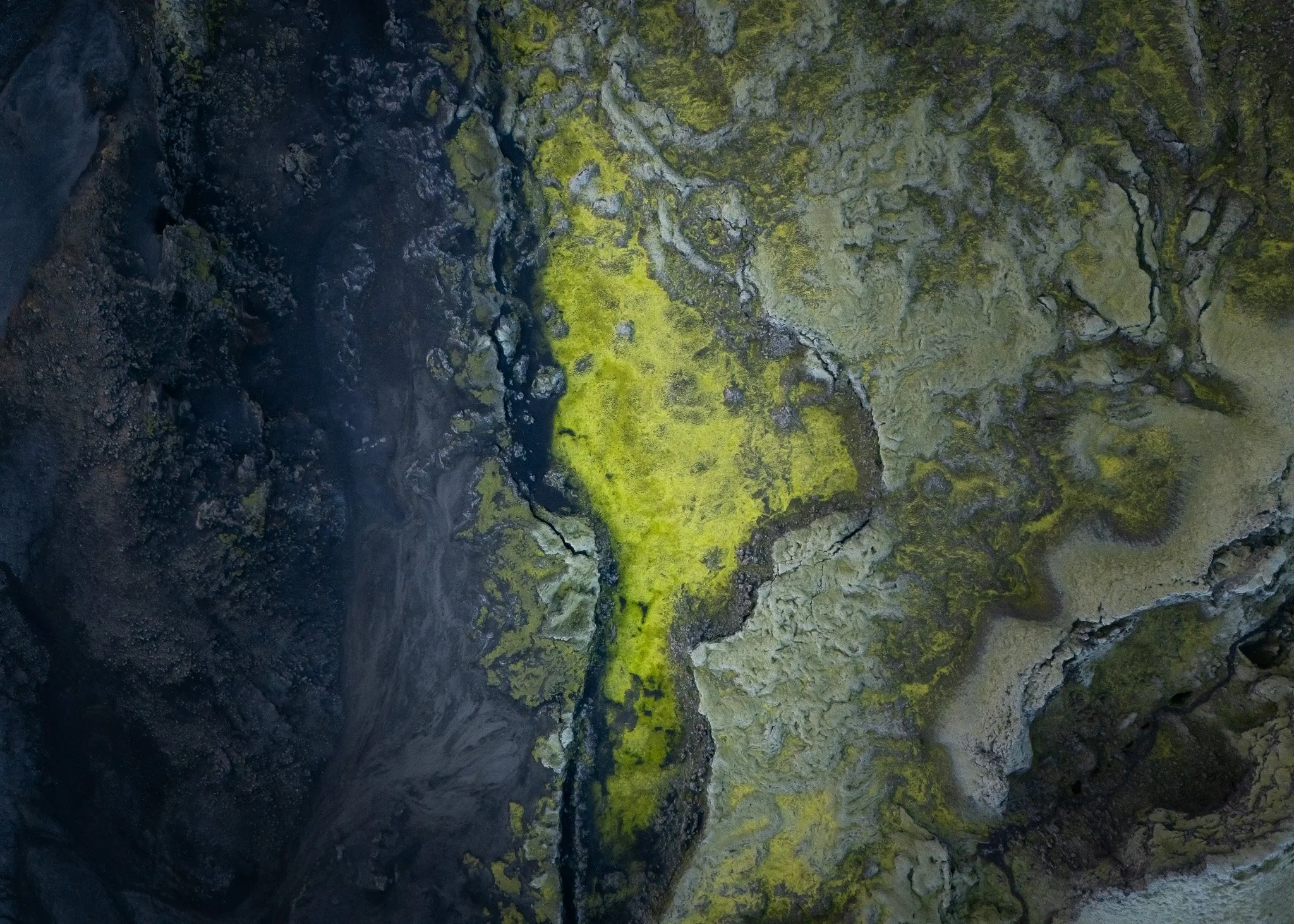
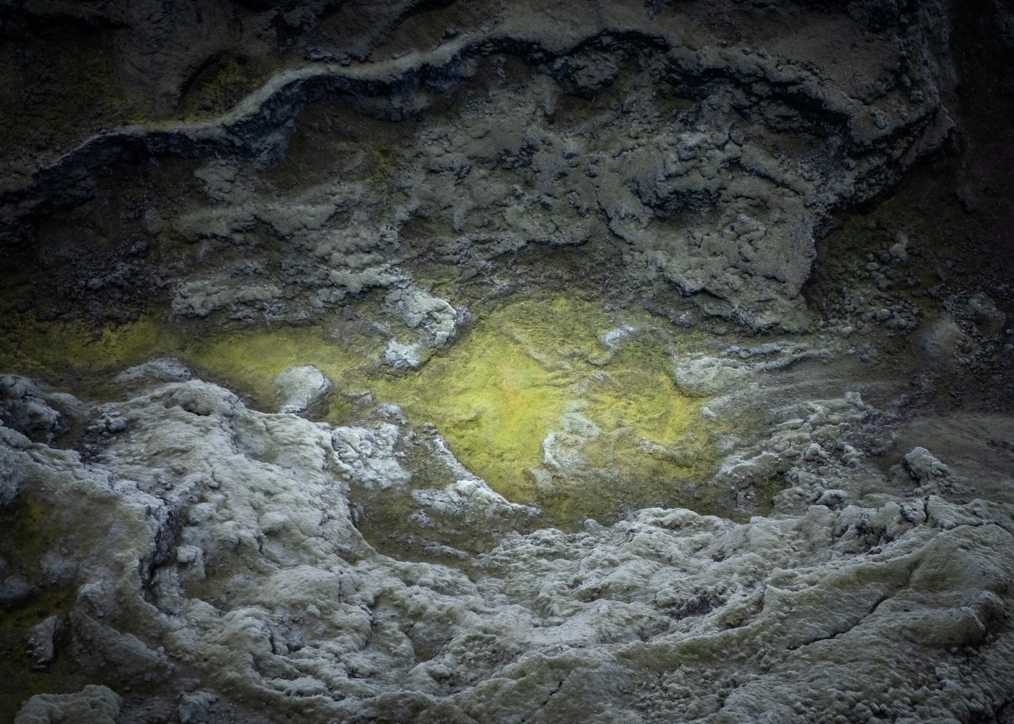
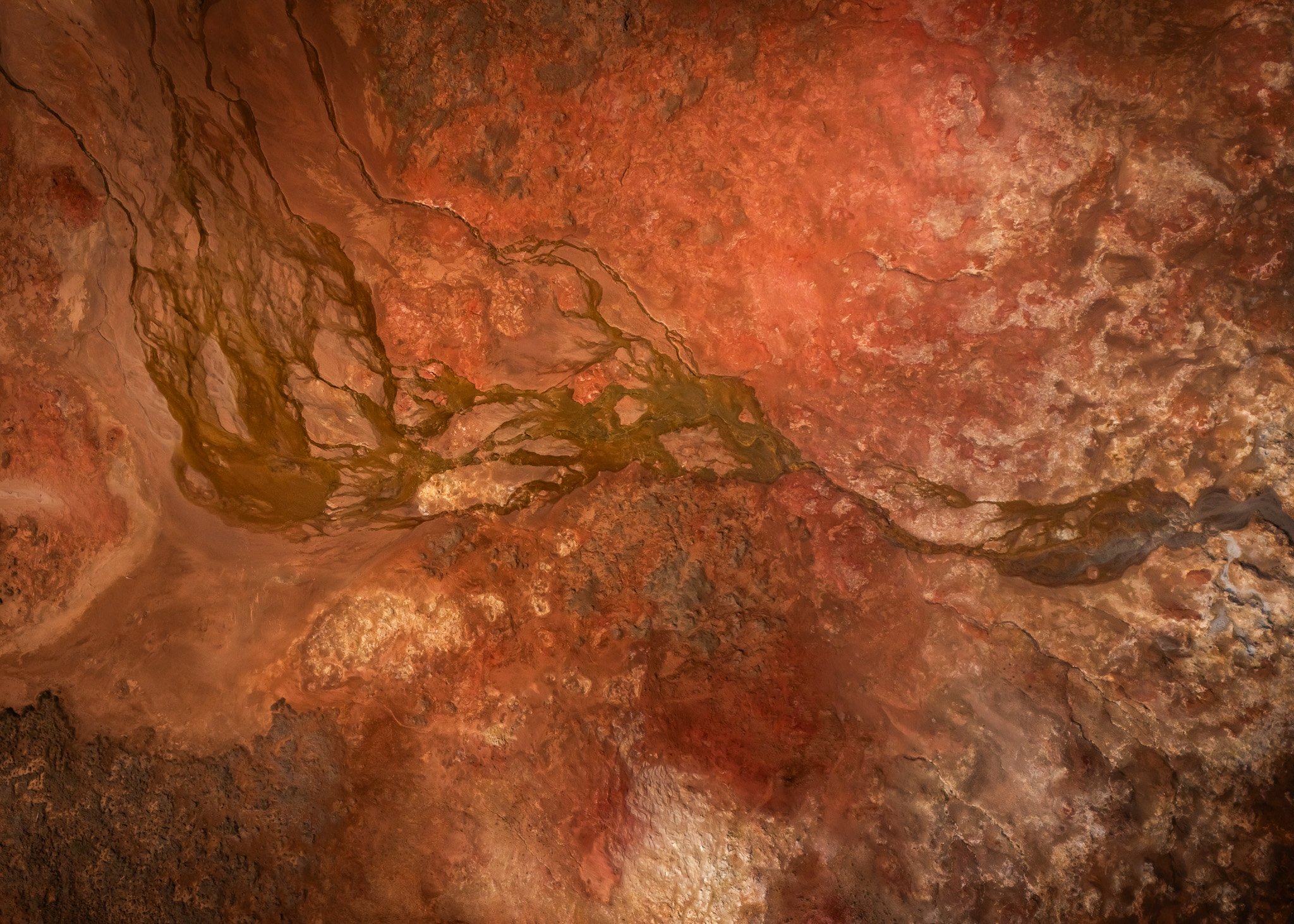
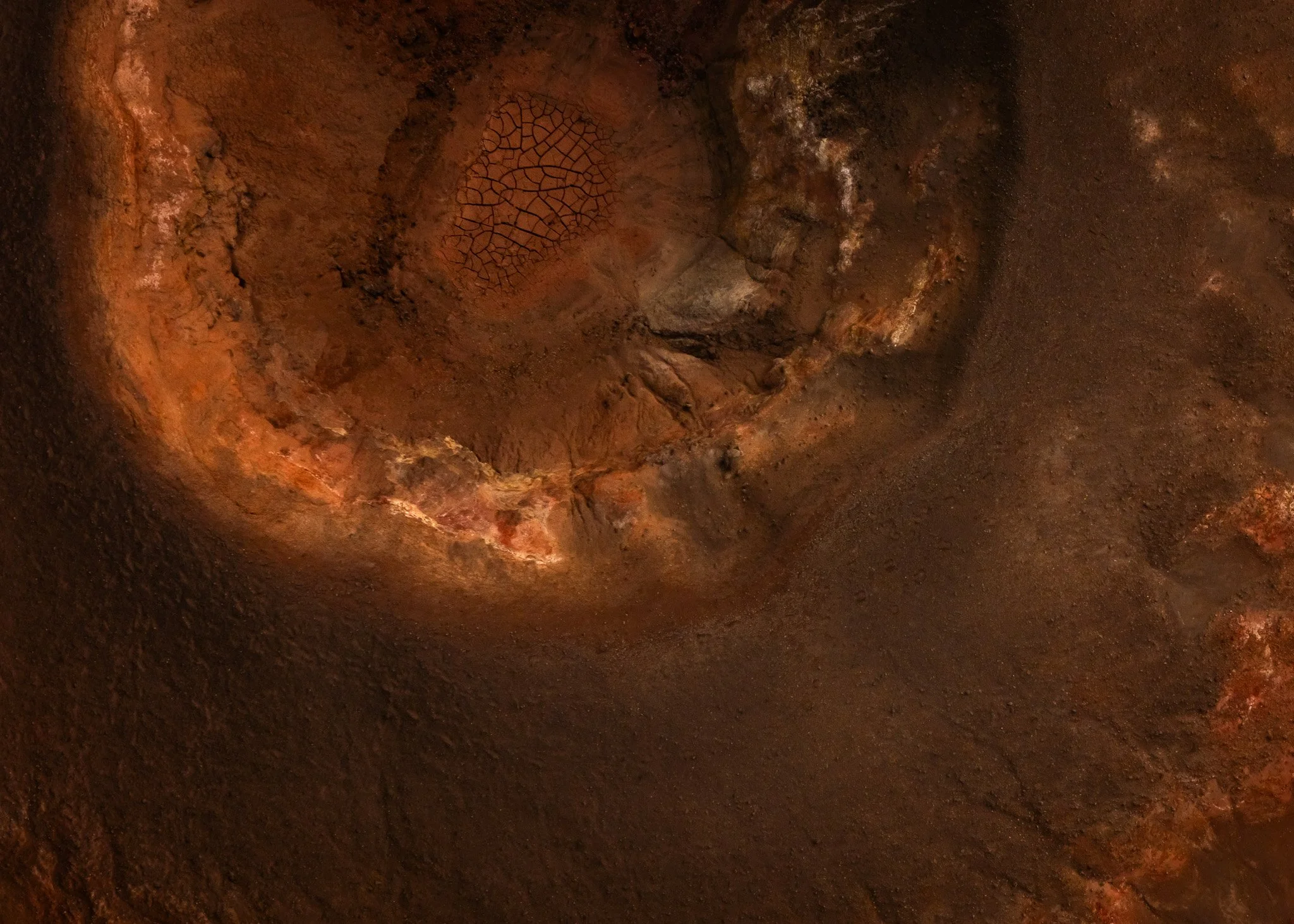
Around areas like Krafla and Mývatn dozens of ochre-colored craters appear scattered across darker lava plains almost like brushstrokes painted into the landscape. Reds, oranges and deep brown volcanic tones contrast against black basalt and occasional snow, creating aerial scenes that sometimes looked more like abstract paintings than natural terrain.
Landmannalaugar felt similar in another way.
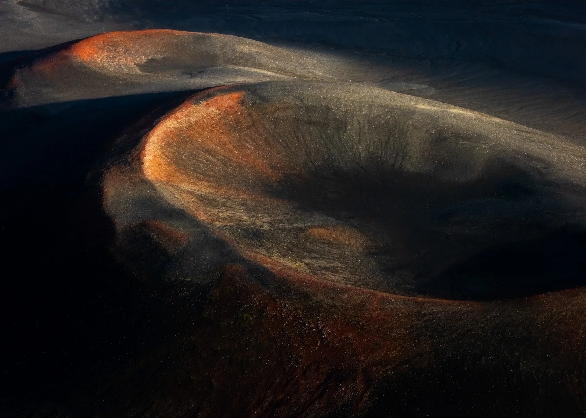
Places like Rauðaskál looked almost playful from the air, with strange bands of reds, greens, black volcanic textures and oxidized minerals creating landscapes that barely seemed real. The formations there felt less like ruins left after eruptions and more like experiments where geology itself was testing color combinations across the mountains.
And during winter everything became even more surreal.
Frozen river systems twisted through volcanic plains like giant white veins while snowstorms moved between crater edges and lava ridges. I remember multiple moments standing completely alone in the Highlands staring at the drone monitor in disbelief because I had genuinely never seen landscapes behaving visually like that anywhere else in the world.
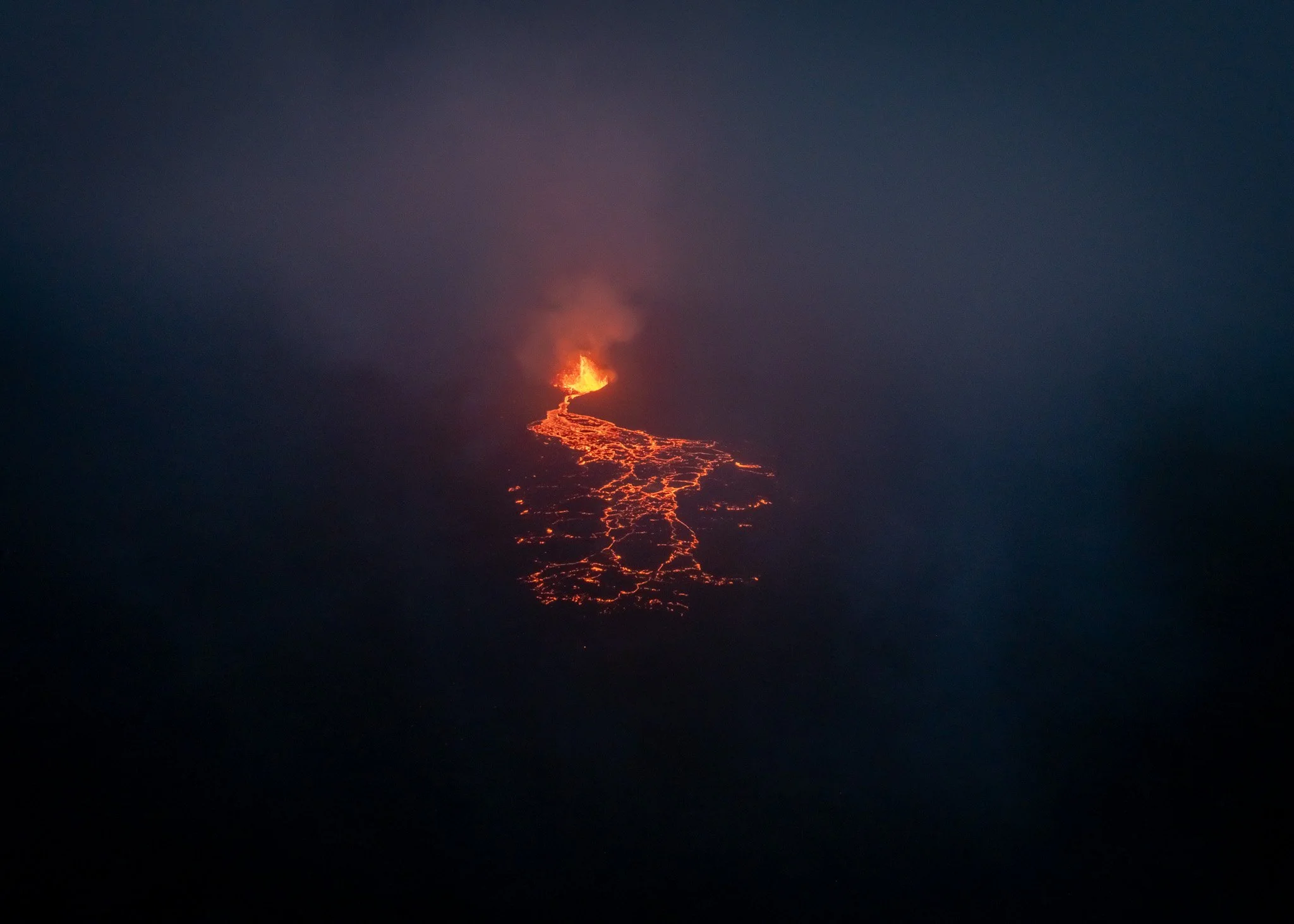
Reykjanes And Watching Iceland Wake Up Again
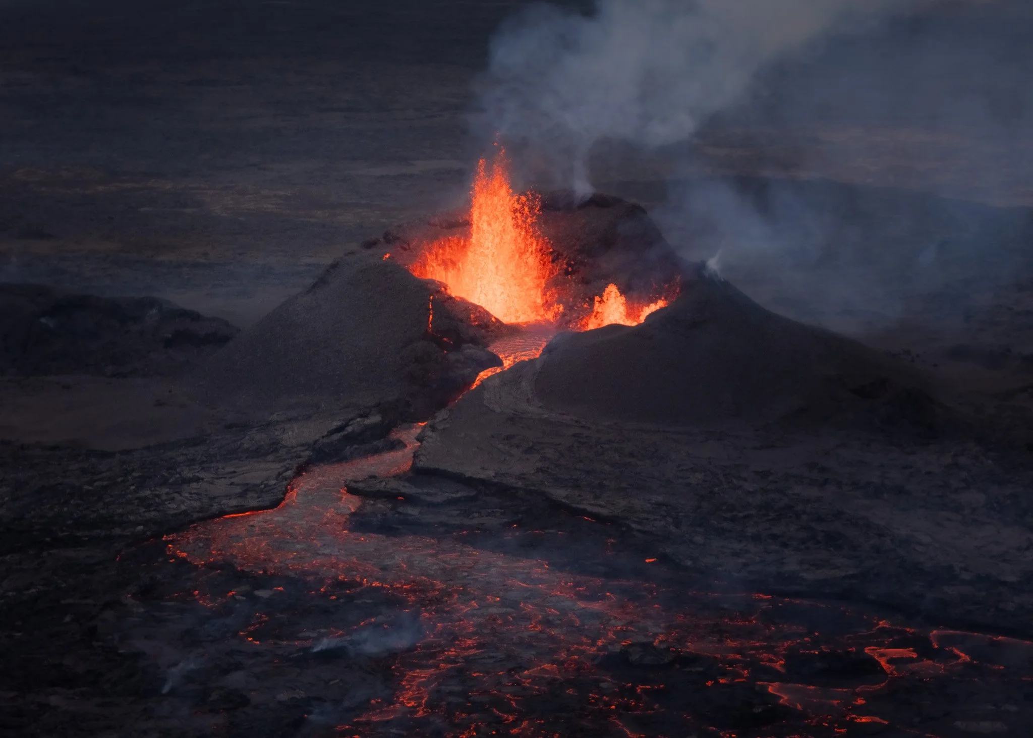
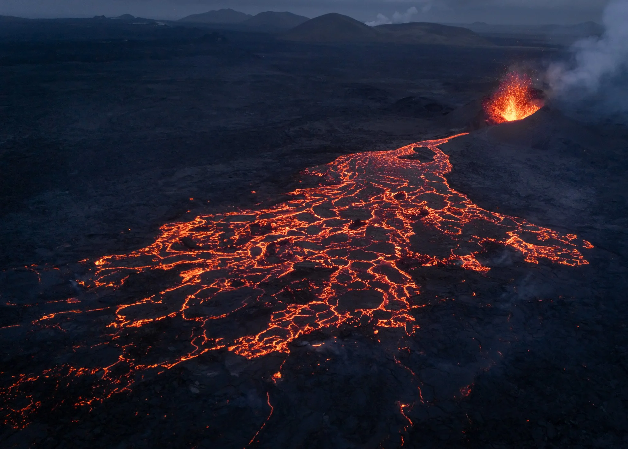
One of the most fascinating parts of these years was witnessing Iceland’s volcanic activity return again on the Reykjanes Peninsula.
Unlike dramatic explosive eruptions shown in movies, these eruptions often felt strangely calm and hypnotic. Lava slowly emerged through long fissures in the earth, spreading across the landscape while entirely new volcanic formations appeared almost in real time.
What made Reykjanes feel so unique was that the landscape visibly changed every single day.
New cones formed.
Lava rivers shifted direction.
Old surfaces collapsed.
Steam and gas constantly reshaped the atmosphere.
It did not feel like witnessing a single eruption event.
It felt like watching Iceland continue building itself.
Photography Slowly Became Soundscapes
Somewhere during these years the project stopped becoming only about photography and slowly evolved into something much larger creatively.
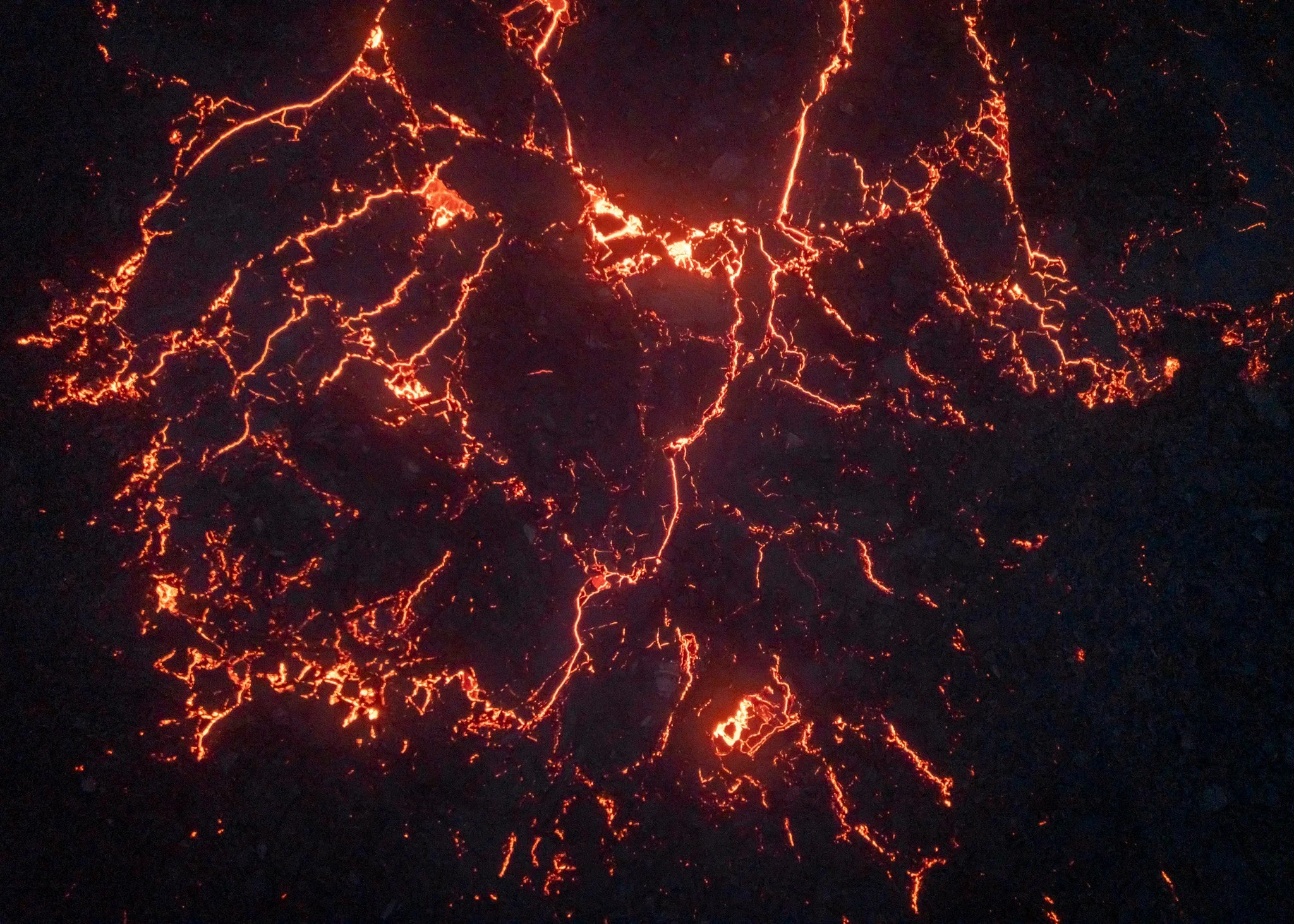
The volcanic landscapes eventually became the foundation for Soundscapes, a project combining aerial photography, live improvised music and volcanic environments into one experience where image and sound respond to each other almost like different interpretations of the same geological forces.
The aerial photographs began feeling less like documentation and more like visual compositions shaped by pressure, rhythm, silence and eruption patterns. Lava textures resembled brushstrokes. Crater systems looked almost musical from above. Frozen rivers created abstract structures across volcanic plains that felt rhythmic somehow.
And that connection between volcanic movement and music slowly became the heart of the entire project.
Not nature as scenery.
But nature as an active force constantly creating, breaking apart and reshaping itself.

More Than 140 Craters Later
After photographing more than 140 volcanic craters across Iceland, I still feel the exact same excitement before entering the Highlands.
Because Iceland never fully reveals itself.
Every storm changes the atmosphere. Every season transforms the terrain completely. Some craters feel calm during summer midnight light and almost terrifying during winter fog. Places I photographed many times suddenly become unrecognizable once snow, volcanic dust or low clouds move through them differently.
And honestly, I think that uncertainty became the real reason I kept returning.
Because somewhere beyond the next mountain ridge, hidden behind fog or buried deep inside Iceland’s volcanic deserts, there is always the possibility that the landscape will suddenly transform into something completely unreal again.


Practical Details — How I Scout Unique Volcanic Locations
Most of these locations don’t come from guidebooks or marked viewpoints. They start long before Iceland, usually at a desk, staring at satellite maps for hours.
Google Earth and satelite data became one of the most important tools in the entire process. I would scan lava fields, Highland basins and fissure zones looking for subtle circular shapes, unusual color shifts in the terrain or patterns that suggested hidden crater systems. After a while you start recognizing Iceland’s “language” from above—how volcanic landforms repeat, break and connect across different regions.
But finding a dot on a map is only the beginning.
The real work is understanding conditions.
In Iceland, the same crater can look completely different depending on weather, light and season. Fog can simplify chaotic lava fields into minimal abstract shapes. Snow can erase depth entirely. Strong wind can lift volcanic dust and completely change the atmosphere in minutes.
That’s why weather planning became as important as location scouting. I constantly checked wind, cloud cover, precipitation and road conditions—especially for the Highlands, where situations can shift fast and access can change within hours.
Field reality is often very different from the map.
F-roads can be rougher than expected, rivers can rise quickly with glacier melt, and many areas have no signal, no traffic and no backup options. Some days I drove for hours only to turn back because conditions made it unsafe to continue. Other times, I reached places that looked perfect on maps but didn’t work visually at all.
And sometimes the opposite happened.
I would stop somewhere with no expectations, launch the drone in difficult light or weather, and suddenly discover something completely unexpected—patterns, textures or crater formations that became some of the strongest images of the whole project.
Over time, I learned that scouting in Iceland is less about finding “the spot” and more about timing, patience and accepting uncertainty.
Because the landscapes are always there—but they only reveal themselves under the right conditions, often briefly, and never twice in exactly the same way.
After three years of returning again and again to Iceland’s volcanic landscapes, what stayed with me most was not any single crater, location or image—but the constant feeling that nothing is ever finished here.
Iceland is not a landscape you “complete.” It is something you keep meeting in different states, under different weather, light and silence. The same crater can feel calm one year and almost alien the next. Familiar places become unrecognizable when fog, snow or volcanic dust changes their structure completely.
Looking back at more than 140 craters, the project slowly became less about documentation and more about attention—learning how to see change instead of stability, and how to accept that the most interesting moments often arrive unexpectedly and disappear just as quickly.
In the end, what I was really photographing was not only volcanic terrain, but a landscape in constant motion. A place that is still being formed.
And maybe that’s why I keep going back.
Because Iceland never gives you the same version of itself twice.